Archive for the ‘CARQUINEZ STRAIT-LOOP’ Category
Ride Report……Port Costa Loop, Part II

Long overdue, this is Part II of my ride report.
(Here is Part I and here again is the map of the route).
The broad outlines of this ride came to me as I looked at the location of my friends’ house on a map. This would be a circumnavigation, via two major urban bridges, of the Carquinez strait — a watery narrows that California’s two mighty rivers, the Sacramento and San Joaquin, must pass through before emptying into the San Pablo and San Francisco Bays.
Port Costa — surrounded by rolling green hills — was the perfect launching point for such a ride.
Miles 0-10: From Port Costa to Martinez bicyclists can use the old highway, which is closed to car traffic. I passed the occasional hiker and was treated to rolling hills, scenic views of the water and the old rail road tracks, and a final, satisfying descent into the town of Martinez. I breezed in feeling energized and thus decided to go looking for the John Muir historic monument rather than sticking to the course I had initially set. (Read about that side trip here).
Miles 11-20: The second third of the trip took me from downtown Martinez across the Benicia Bridge to Southampton Bay and the Benicia state recreation area. This was easy, pleasant riding never too far from the shoreline. I rode past past marinas filled with expensive yachts and late Sunday afternoon picnic goers. I stopped frequently to make photographs and found my way using a variety of bike paths and shared roads. I was never entirely sure if I was on my planned route, but I wasn’t too concerned as “Bike Route” signs were plentiful and all roads seemed to propel me toward the state park.
Miles 21-30: During the last third of the trip, after leaving Benicia state park, the route finding and bicycle riding became more difficult. The bike lane ended and I had to navigate a number of challenges:
- first was a curving, shoulder-less off-ramp leading up to Columbus Parkway and a narrow two-way bridge near the intersection with I-780.
- route finding became more difficult since I screwed up my Google bicycling directions by accidentally printing a mirror image of the route (starting at point B going to A, rather than A to B). As a result, I had to read the directions backwards (from the bottom of the page up) and calculate whether left and right turns were also reversed. It was a mess.
- a critical street sign was missing and as I pedaled up what seemed the biggest incline of the trip I was unsure if was even on the correct road (later I confirmed I was on Benicia Rd.).
- in order to find the approach to the bike/ped path of the Carquinez Bridge I had to cross three major interstates (I-780 2 times and I-80 once) and pedal through a few gritty urban neighborhoods (riding in normal street clothes, rather then a skintight lycra outfit, never felt more right).
- since I began my journey after 4:30pm the onset of darkness was a real issue (I don’t have a lighting system on this bike).

So, I pedaled hard the last 6-7 miles, crossed the Carquinez Bridge as the sun dropped below the horizon, and managed to arrive back in Port Costa just after 8pm.
My friends had taken a twilight stroll and were not yet home. I was a little tired and rather hungry (since I didn’t eat anything on route), but took solace in the satisfaction of having just circumnavigated the Carquinez Strait.
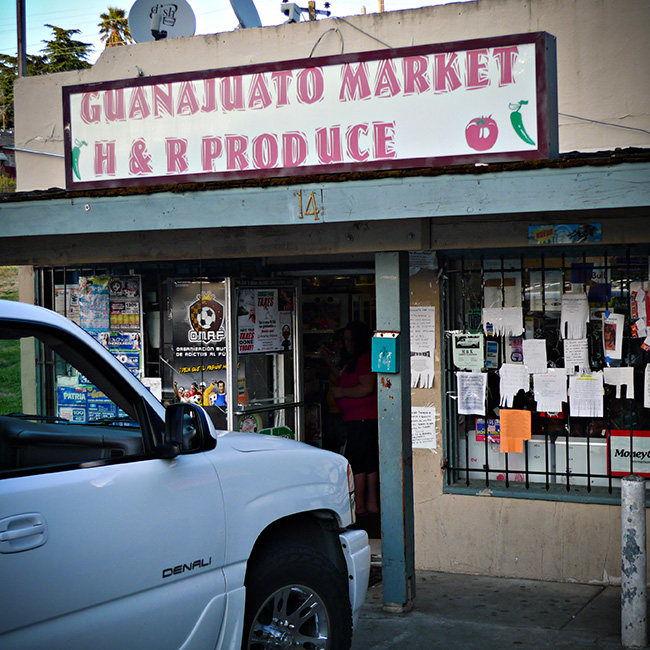
On the Road……Local Bodega, Vallejo CA
On the Road……I-780 Overpass

On the Road……My three least favorite words: BIKE LANE ENDS

On the Road……Carquinez Strait Loop, near Benicia
Part 1 of my ride report was published awhile back. Stay tuned for Part II and the last of the photos from this scenic loop ride.
* Remember you can always click the  Show on map under the photo to view the location on a map.
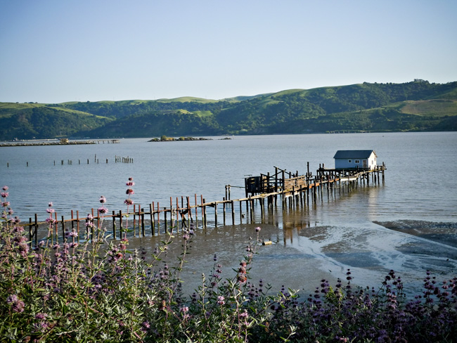
View of the Carquenez Strait looking south from Benicia
The photo caption says it all.
On the Road……Port Costa/Carquinez Strait Loop

I don’t know much about these except that they are often called ice plants, which is a bit of a misnomer since they’re quite hardy and thrive in full sunshine.
Most likely these are a pesky invasive species. Nonetheless, they’re often growing en masse along California highways. The flowers’ vivid color is impressive when in full bloom.
On the Road……Port Costa/Carquinez Strait Loop
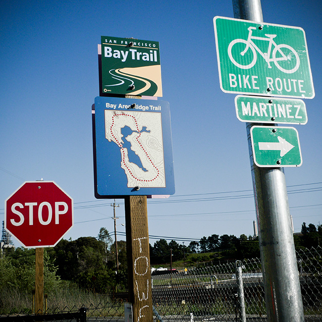
Getting on the Martinez-Benicia Bridge
Most of this route has well-marked signage. (But over the last third of the ride I did have a little trouble finding my way. See Part II of my ride report for details.)
On the Road……Carquinez Strait Loop, near the Benicia Bridge
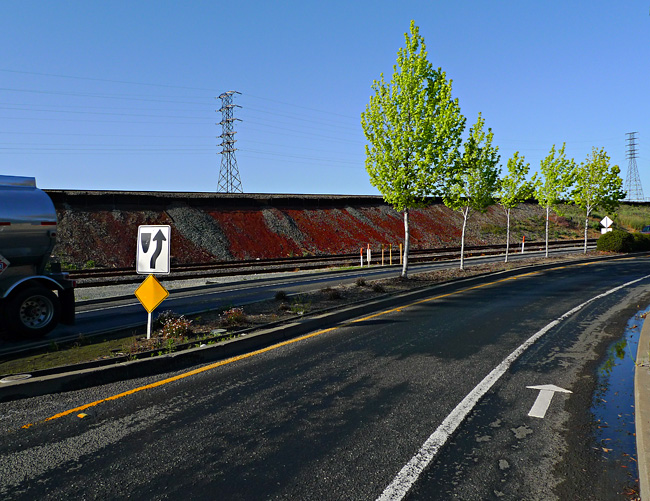
Excellent Class II BIke Lane
Among urban planners:
- Class I is a completely separate bicycle/pedestrian path or roadway (like you see all over Holland).
- Class II is when there’s a separate lane for bicycles (like in this photo).
- Class III is just a shared road, maybe with some road markers here and there.
On the Road……Martinez, and the John Muir House
 You can see from the little squiggle on the Port Costa route map that I made a slight detour from my planned loop.
Here’s what happened:
Noticing the sign “Martinez” as I entered town caused a little voice deep inside my head to say clearly: “Martinez is known for something...?”
It took a few blocks of me pondering, “Martinez, Martinez” and then it struck me — John Muir’s House is in Martinez!
I stopped to ask directions and it was easy enough to find. I went a few miles south on Alhambra Avenue toward Highway 4 and there it was on the right, just past a Vietnamese nail salon and a Subway sandwich shop.
John Muir is one of my all-time heroes. He’s up there with Bodhidharma, Gandhi, Emerson, Thoreau, Gary Snyder, Wendell Berry, Ed Abbey, Aldo Leopold, Cabeza de Vaca, Charlie Chaplin, Walt Whitman, Muhammad Ali, and Velocio.
So I was a little disappointed the historic landmark was closed for the day when I arrived. I just peered in, past the parking lot gate. The place felt a bit sad and ironic, surrounded by its suburban infrastructure.
Even in his day, Muir was not entirely happy in Martinez, so far from the cheerful water ouzel and his beloved High Sierra.
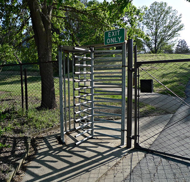
Exit Gate of the John Muir Historic Landmark
On the Road……Port Costa Loop, Old Martinez Highway

Heading east for Martinez on the old highway from Port Costa, I was treated to a rare stretch without any car traffic. This old road is now closed to vehicles and it’s starting to break apart in places — reclaimed by the forces of wild nature!
Ride Report……Port Costa Loop, Part I

On Saturday, my friends Forest and Ingrid invited me out to their place in Port Costa — a quirky, Bay Area town (that almost no one has heard of) along the Carquinez strait, surrounded by parks, open space, rolling hills, ravines, pastures, and water views.
I brought my Guerciotti along so I might sneak in a bike ride. I didn’t have a specific route in mind, but the weather was ideal and I anticipated the area would have some great roads.
Ingrid is from Romania and she prepared a delightful tray of appetizers: home-made bread, thinly sliced daikon radish, country cheese, raw milk, strawberries, olives, honey, and sun-dried tomato tapenade. I washed it down with a refreshing Pilsener and then we took a walk down to the old railroad tracks and the shoreline.
Standing near the water, I realized a grand loop around the Carquinez Strait was possible — provided the two bridges accommodated bikes. A neighbor confirmed they do and so I printed out some Google bicycling directions and set out for a ride.
I departed Port Costa around 4:40pm with just a small bottle of water and the food in my belly. I wore my regular clothes: corduroy pants and a lightweight, long sleeve collared shirt over a cotton t-shirt, cotton socks, a baseball cap, Adidas Sambas, and a lightweight hoodie (which I stowed in my handlebar bag should it get cold around sundown).
TO BE CONTINUED…in Part II
Route Map……Port Costa Loop
On the Road……Port Costa Loop Ride

That’s Mount Diablo (El. 3,864′) on the horizon. The slopes and trails of Diablo are where Grant Petersen and the good folks at Rivendell Bicycle Works do their thing.


