Archive for the ‘panoramas’ tag
On the Road……Panorama, Paradise Drive, Tiburon

 Show on map
TIburon peninsula on the left. Angel Island on the right.
A beautiful, sunny day in this micro-climate, but note the white clouds around the island. That’s fog enveloping most of the bay (as seen in the pictures in the above post made not too long after this one). As I mentioned in my ride report, I was tempted to bail out on this ride. I’m really glad I didn’t.
On the Road……Azalea Hill (EL 1,217′)

Atop Azalea Hill
There’s a lot of cloud cover, but the East Bay is just visible on the far horizon. Mt. Tamalpais is the third peak from the right with Bon Tempe Lake right below.
(I combined five images to capture the whole panorama. Here’s my favorite example of this technique: Nicasio reservoir.)
On the Road……Pt. Reyes National Seashore

Are you getting bored with panoramas yet?
The novelty is starting to wear off for me, but they do give a pretty good sense of the landscape so I’ll keep composing these whenever the inspiration strikes (and I’m still quite thrilled with my first try at this format, originally posted here).
On the Road……More Panoramas Mt. Tam

click to enlarge
I couple weeks ago I posted my first panoramic image. I’m still intrigued by the photomerge feature of Adobe CS3.
On the Road……More Panoramas, Ridgecrest to Mt. Tam

On the Road……Nicasio Reservoir
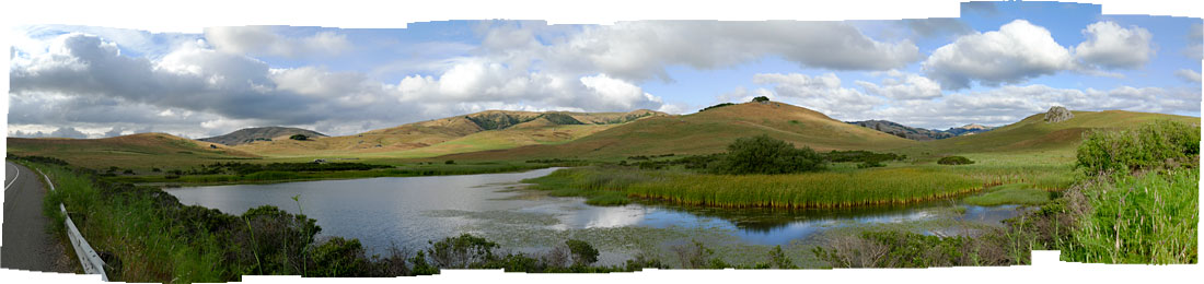
click to enlarge
Today’s thunder showers never materialized so I headed out toward Petaluma this afternoon. The image looking east on Nicasio Valley Rd. near the reservoir is made up of 12 vertically composed images stitched together using the “photomerge” tool in Adobe’s Photoshop CS3. The weather, the clouds, the light: it was jaw-droppingly beautiful!

