Route Map……Ridgecrest Boulevard with Pacific Ocean View
 Show on map
Northern California just had a glorious little heat wave. This last gasp of Indian Summer resulted in hot sunny weather with temperatures in the 70’s, and even 80’s, over the week-end.
And for some reason, I got it into my mind late Sunday afternoon that I had to ride until I could get a view of the Pacific Ocean.
The easiest way to accomplish this goal was a 25 mile round-trip with about 2,600′ of vertical climbing.
Here’s a route map and a one-way elevation profile from the ride:
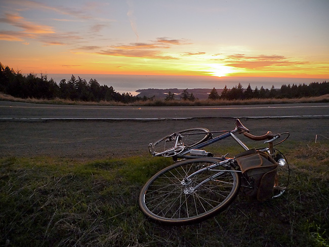
The spit of land in the above image (just past the line of trees) comprises the town of Bolinas and the Pt. Reyes pennisula.
More pictures and a short ride report to follow.


Wow, you have truly outdone yourself with that photograph. I look at that sunset and think, “that is where I want to be”.
Bravo! Jack
The Velo Hobo
22 Nov 10 at 4:19 pm
jack/ thanks! i lucked out and arrived 10-15 minutes before sundown.
fridaycyclotouriste
22 Nov 10 at 11:52 pm