Archive for the ‘water’ tag
On the Road……Sabino Creek: An ode to Tucson’s watershed

This small stone cairn caught my eye, perched in the middle of a mostly dry Sabino Creek.
The creek corridor is full of ash, cottonwood, willow, sycamore, and other riparian species. When the creek is running — as a result of snow melt and rainwater flowing down from the Catalina Mountains — Tucson’s underground aquifer is re-charged.
Sabino Creek also feeds the Rillito River, which feeds the Santa Cruz River, which feeds the Gila River, which feeds the mighty Colorado River, which in turn feeds the Sea of Cortez (or Gulf of California).
The hydrologic cycle comes full circle when this water returns to Tucson in the form of summer monsoons and winter rains, and flows down Tucson’s Sabino Canyon once again — a wondrous ebb and flow 10 million years in the making.
Nathan
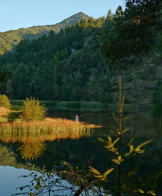
On the Road……Meadow Club, Fairfax

 Show on map
I live in a region with a drought prone mediterranean climate and so expressing one’s feelings about the rain (its frequency and abundance) is a local past-time and, I think, a reflection of becoming a true inhabitant of this dynamic ecological assemblage.
I love the rain — especially late season March/April rains, but it also reduces my riding (above is a fair weather picture from a mid-month ride).
And despite many rumors to the contrary, rainfall this year is just “average”. But “average” = “great” because now our reservoirs are finally full.
Stats from MMWD’s website:
Average year-to-date rainfall (inches): 46.3
Actual year-to-date rainfall (inches): 45.1
Current, reservoir storage (% of capacity): 99
Same time last year, reservoir storage (% of capacity): 84
Now we need to hope plans to restore native Coho salmon populations will soon start paying off.
On the Road……To Lake Lagunitas
Lake Lagunitas
Lagunita (the Spanish word for ‘little lake’) is the oldest and smallest lake in the watershed. It is also the highest in elevation (notice it’s relationship to the summit of Mt. Tam in the background).
Once you ride up here there’s a lovely little path circling the lake (see my route map).
But calling Lagunitas a lake is a bit of a misnomer: Lagunitas is really a man-made reservoir. One of seven reservoirs providing 75% of the county’s water supply.
The future of this supply is threatened, according to MMWD:
Our analyses show that current water supply will be insufficient to meet projected demand. This shortage would become severe in the event of a serious drought…We can get through one or possibly two dry years, but we would not be able to adequately supply our community in a longer drought.
Yikes!
Luckily, someone is paying atention. The intrepid little non-profit, Sustainable Fairfax is once again taking the lead:
Water project staff and volunteers will be approaching every business, school and resident in Fairfax to see “How Far We Can Go” to reduce our water use through technology and behavior. The idea is to focus intensively on one community to increase water conservation to see if that is an effective model resulting in long-term water savings.
(Note: It was too dark when I arrived to get a satisfactory image. The above shot of Lake Lagunitas was made this past summer…yes, fishing with a permit is allowed.)

