Archive for the ‘FAIRFAX-to-BOLINAS’ Category
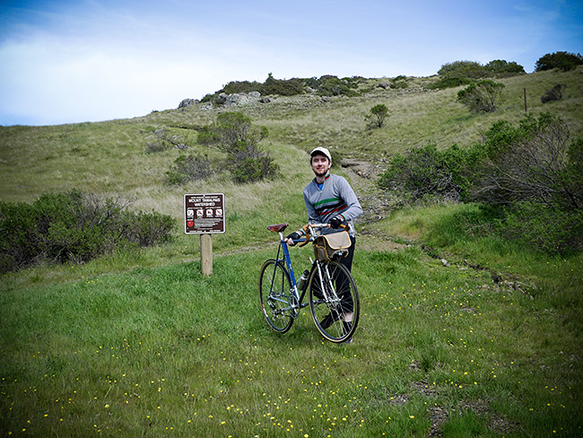
On the Road……Bolinas-Fairfax Road, near the Lake Lagunitas turn-off

 Show on map
This may not look that steep, but it often feels it (as it’s part of a fairly long climb that eventually crests at the top of the Bolinas ridge).
This rider is almost to the Lake Lagunitas turn.
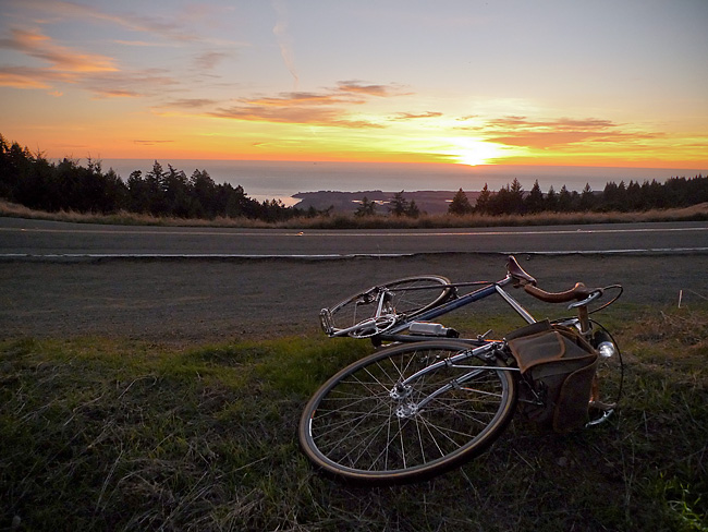
On the Road……Atop the Bolinas Ridge at Civil Twilight

This image from my recent ride along the Bolinas Ridge captures the specific time of the evening — civil twilight — when ambient light takes on a lovely bluish hue prized by painters and photographers.
Twilight, broadly speaking, refers to the time between sunset and dusk AND the time between sunrise and dawn (the chart below is a helpful tool for visualizing this).
But twilight (both morning and evening) is divided, more scientifically, into civil, nautical, and astronomical segments based upon the number of degrees the center of the sun is below the horizon (6, 6-to-12, and 12-to-18 degrees respectively).
Evening nautical twilight (nautical dusk) is said to end once sea navigation via the horizon line is no longer possible. Evening astronomical twilight (astronomical dusk) ends once the dimmest celestial objects (e.g. galaxies and nebulae) become properly visible to astronomical observation.
Commentary: in the context of the virtual world of Texting, Tweeting, and Tagging (from which I claim no exception) it feels palpably iconoclastic (if not downright subversive) to patiently witness our solar system’s sun disappearing ever so gently beyond the planet’s watery horizon.

Chart delineating Dusk, Dawn, and Twilight
Featured Comment by Shoeless Joe: “There is a biological connection, too, as the rods and cones in our eyes perceive light differently at twilight. It is called the Purkinje Shift (or Purkinje Effect). Wikipedia has a good article on it. One of the beauties of cycling is that it affords many opportunities to “patiently witness” the world around us in a way that is unique to the sport.”
Ride Report…A Late Fall Ride and a Pacific Ocean Sunset

I somehow got it into my mind that I needed to see the Pacific Ocean.
The solution was a 25 mile loop — from Fairfax up to and along Bolinas Ridge offering winding roads; steep climbs; fast descents; water and commanding Pacific Ocean views; relatively few cars; redwood forests; oak-studded grasslands; colorful autumn foliage; and, a smattering of wild life (I saw a coyote on top of the ridge and several deer on the way down).
In other words: there’s a bit of everything on this ride.
I departed around 3:30 pm (it’s getting dark by 5:30 pm) so I attached a headlight that I bought for my Brompton folding bike on the Guerciotti. I packed a persimmon and a wool turtleneck in my handlebar bag and wore a wool t-shirt and wool knickers. The weather, however, was unseasonably warm and I was comfortable for most of the ride in just the t-shirt. (Toward the end of the ride, I draped the sweater around my shoulders and tied the sleeves in a loose knot to keep it from slipping.)
I spent most of this ride chasing the sun. I’d catch it, then it would dip behind a ridge. This continued until I got to the final, long climb with the sun well hidden behind the ridge. But as I slowly pedaled up the road — and the 1000′ vertical feet of switch-backs — I realized that at the very top the sun would make a final appearance.
As the image shows, I caught the sun for the final time as I rode atop the ridge.
So what about the bicyclist in the picture?
I passed him about 6 miles earlier, but since I’m always on-and-off my bike making photographs he caught up with me (think of the tortoise and the hare). When I noticed him climbing up the ridge about 100 yards behind me I set-up for this photo.
As the tortoise passed me, I exclaimed, “That’s a beautiful picture!” The tortoise turned briefly toward the sunset and replied, “it’s not real”.
At first I thought he was referring to the almost hyper-real colors (you know how sometimes nature reveals scenes — especially cloud formations and sunsets — that would be unbelievable had you not witnessed them with your own eyes?).
But on further reflection, maybe he was referring to photography itself and the philosophically problematic nature of attempting to reproduce reality with a machine!
Anyhow, I lingered on the ridge for 10-15 minutes and watched the sun dip below the horizon. Mosquitoes bit my arms and legs. I devoured a persimmon then turned on my headlight and rode home.
On the Road……Persimmons: A Most Refreshing Snack

Part of the fun of having a bike equipped with a handlebar bag is how easy it becomes to carry whatever strikes your fancy. I’ll often pack bread, cheese, nuts — sometimes even a small amount of wine!
For this ride out to the ocean, I brought my handlebar bag basics: a few tools, spare tubes, a camera, a cell phone, and a GPS device.
But the extras for this trip consisted of an extremely light merino wool turtleneck (for after sunset) and a persimmon — a sweet, refreshing bit of energy to consume at the turnaround point.
 Wool sweater and persimmon — packed and ready for the ride.
On the Road……Rough Pavement Begets Wide Tires

Roads like this are a big reason why I always recommend wider tires (28mm and above) at lower pressures (50-80psi).
Riding over rough roads on hard, skinny, racing tires (which 95% of bikes seem to have) doesn’t make a lot of sense.
Jan Heine, publisher of Bicycle Quarterly, who I consider an authority on the subject, has done extensive testing of tires at different widths and at different pressures and concluded that wider tires, at lower pressure, can outperform skinny racing tires.
My Guerciotti uses 28mm tires, my Ebisu uses 38mm tires, and I hope to design a future bike around 42mm tires.
(Note: The image was made on the climb through the redwoods up to Ridgecrest Blvd. on way to catch a glimpse of the ocean).
Route Map……Ridgecrest Boulevard with Pacific Ocean View
Northern California just had a glorious little heat wave. This last gasp of Indian Summer resulted in hot sunny weather with temperatures in the 70’s, and even 80’s, over the week-end.
And for some reason, I got it into my mind late Sunday afternoon that I had to ride until I could get a view of the Pacific Ocean.
The easiest way to accomplish this goal was a 25 mile round-trip with about 2,600′ of vertical climbing.
Here’s a route map and a one-way elevation profile from the ride:
The spit of land in the above image (just past the line of trees) comprises the town of Bolinas and the Pt. Reyes pennisula.
More pictures and a short ride report to follow.
On the Road……Olema’s Giant Eucalyptus Trees

The specimen below is probably the largest Eucalyptus I’ve seen. These trees are native to Australia and were originally planted in California — I’m guessing — as wind breaks for ranches and farms. They are quite draught resistant, making them extremely productive trees in this climatic zone. Plus, they smell really good!

On the Road……Highway 1 @ Vedanta Retreat, Olema

Just outside of Olema lies the Vedanta Retreat center.
I pedaled up the entry driveway past what they call the Vivekananda Bridge. There really was a palpable sense of peace and calm, maybe because for the last 37 years this has been a place “…where spiritual seekers of all faiths may meditate and study away from the disturbances of urban life.”
Here’s a synopsis of Vedanta philosophy from the Vedanta Society of Northern California‘s website:
The basic teaching of Vedanta is that the essence of all beings and all things–from the blade of grass to the Personal God–is Spirit, infinite and eternal, unchanging and indivisible. Vedanta emphasizes that man in his true nature is this divine Spirit, identical with the inmost being and reality of the universe. There is, in short, but one reality, one being, and, in the words of the Upanishads, “Thou art That.”
Vedanta declares that one can realize God in whatever aspect one wishes, and, further, that one can realize him directly and vividly in this life, in this world. Such realization constitutes spiritual freedom and contains in infinite measure the fulfillment of all man’s ideals and aspirations; it is indeed the true purpose of human life.
Vedanta holds that all religions lead to the same goal. Further, Vedanta reveres all great teachers and prophets, such as Sri Krishna, Lord Buddha, and Jesus Christ, and respects their teachings as the same eternal truth adapted to the needs of different times and peoples.

On the Road……Sir Francis Drake Blvd @ Highway 1

A typical Marin County bulletin board: “Holistic Lawyer”, “Way of the Goddess”, “Mystic Roots Band”, “Gurdjieff” and a plumbing contractor.

Downtown Olema

SFD Blvd @ Highway 1
Sir Francis Drake Blvd. is eponymously named after the English explorer, pirate, slaver, and planet circumnavigator (Sir Francis Drake, b.1540-1596) and was once slated to become a four-lane highway known as CA Route 251:
…However, the development and freeway planning were stopped due to concerns about fragile ecosystems that urbanization would have damaged or destroyed….There was another problem though: the plan put the entire area on the San Andreas Fault. The decision to not redevelop West Marin made the freeway unnecessary, and it was therefore scrapped (from the Wikipedia entry)
On the Road……Olema, End of Indian Summer

I discovered a new swimming hole this year. Just in time, as Northern California’s Indian Summer (usually Sept-Oct) finally ushered in some genuinely hot weather.
Last year’s End of Summer post described another popular swim hole: the Inkwells.
The new spot is about a 15-mile roundtrip from the town of Olema, with mostly rolling hills and the occasional volley of cars skimming by pretty close as there is no shoulder for protection along Hwy 1.
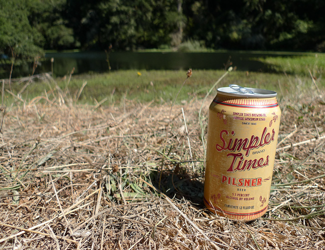
Simpler Times Pilsner
On the Road……Bicycling, Carbon Footprints, and a Sense of Wonder
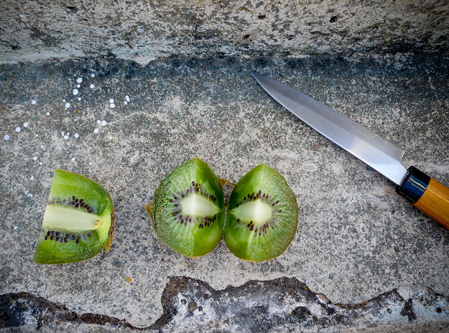
Organic New Zealand Kiwi Fruit
I recently pedaled up to Alpine Lake and had the foresight to pack a little fruit and one of these spiffy stainless steel Japanese Suncraft knives.
As I bit into this juicy kiwi, I remember thinking:
How is it that I’m sitting here now and eating a tiny fruit that was harvested on the other side of the earth?
There was no judgment over the astronomical (one might even say grotesque) carbon footprint of my organic New Zealand kiwi – it was simply a sense of wonder that I live at a time in human history where such an act is even possible.

Note: After writing the above post I discovered that a “sense of wonder” is a recognized concept in science fiction literature. It’s related to a “numinous” experience. Here’s an excerpt from the Wikipedia entry:
The sense of wonder is related to, but not identical to, the concept of the numinous…the numinous, in this case, is the understanding that there is something not directly comprehensible, but large and entirely other, in the world. The sense of wonder, by contrast, is the understanding that there is something that one had not fully comprehended — or perhaps had not even recognized that there was something to be comprehended — until that point.
Bicycling Culture……The Bike Blog Universe

The Velo Hobo (aka Jack from North Carolina) was kind enough to spotlight me in one of his recent “featured rider” posts.
Initially, I told him I was a little embarrassed by the distinction. The cycling community is full of so many riders that are accomplishing amazing physical feats or doing other extraordinary things with bicycles. I felt a little inadequate in this regard. But I’ll continue to do my part, whatever that may be. Thanks Jack!
And this reminds me. I’ve been remiss in acknowledging other blogging friends and supporters of The Friday Cyclotouriste to whom I am most grateful. They include:
- Myles at Rat Trap Press;
- Eddie at The Everyday Cyclist;
- Esteban at velo-flaneur;
- Alan and Michael at EcoVelo;
- Meli at Bikes and the City; and,
- Dave at Yurtville.
All are amazing blogs. I encourage you to visit.
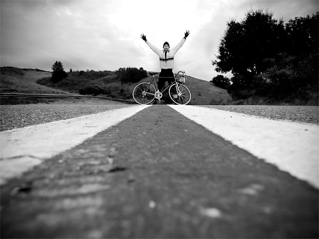
(P.S. The above picture, which I sent to Jack, was made with the camera on the ground using the 10-second timer on a recent Thursday evening ride up the hill near Alpine Lake).
On the Road……Spring time at Azalea Hill Pass
This past Friday I intended to ride to Alpine Lake and back, one of the top 10 short bicycle rides known to humankind IMHO.
But I got distracted by all the wildflowers and only made it to the top of Azalea Hill.
Last time up here I made this photo. I thought I’d share an alternative version highlighting my flashy yellow wind breaker.

And here’s a clumsy attempt to make another 10-second timed exposure at the nearby trail head. (The ground is super saturated and muddy. I had trouble getting set before the shutter released.)
Azalea Hill Trail Head
On the Road……Cumulus Clouds heading toward Azalea Hill

On the Road……Heading toward Azalea Hill Pass

On the Road……Meadow Club, Fairfax

I live in a region with a drought prone mediterranean climate and so expressing one’s feelings about the rain (its frequency and abundance) is a local past-time and, I think, a reflection of becoming a true inhabitant of this dynamic ecological assemblage.
I love the rain — especially late season March/April rains, but it also reduces my riding (above is a fair weather picture from a mid-month ride).
And despite many rumors to the contrary, rainfall this year is just “average”. But “average” = “great” because now our reservoirs are finally full.
Stats from MMWD’s website:
Average year-to-date rainfall (inches): 46.3
Actual year-to-date rainfall (inches): 45.1
Current, reservoir storage (% of capacity): 99
Same time last year, reservoir storage (% of capacity): 84
Now we need to hope plans to restore native Coho salmon populations will soon start paying off.
On the Road……Azalea Hill (EL 1,217′)

Atop Azalea Hill
There’s a lot of cloud cover, but the East Bay is just visible on the far horizon. Mt. Tamalpais is the third peak from the right with Bon Tempe Lake right below.
(I combined five images to capture the whole panorama. Here’s my favorite example of this technique: Nicasio reservoir.)
On the Road……Azalea Hill pass (EL 1,080′)
The making of this photo: (1) place camera directly on road (2) set the 10 second timer (3) grab bike (4) run into the frame and hope to hit a good mark to optimize composition and hope for no cars (5) wait for shutter to fire — still hoping for no cars to come up from behind (6) get the camera and myself off the road as quickly as possible.
I tried this twice (this was the first). It worked just as I had hoped!
Azalea Hill pass
This is an important spot — the intersection of Bolinas-Fairfax and Pine Mountain (fire) roads. Mountain bikers and hikers will often drive here to start at the trail head; road bicyclists will often rest and take water here.
By all means, make the short 10 minute hike from this pass to the top of Azalea Hill (EL 1,217′). You’ll be rewarded with a 360 degree vista including a great view of Mt. Tamalpais and Bon Tempe lake and sight lines extending across the bay to the Campanile on the UC Berkeley campus and continuing on to Mt. Diablo.
On the Road……Rain, Rain, Rain
In between rain showers I went for a little ride around downtown Fairfax today. I spied this cruiser, parked under an awning to keep it dry, I guess. Not even a lock! It’s all good.

On the Road……Happy New Year!
The Friday Cyclotouriste wishes everyone a happy New Year’s Day, 2010. As you spread the joy and benefits of riding bicycles this year may you suffer few flats, encounter many interesting people, consume delicious food and drink, and experience only tailwinds during all your rides!

On the Road……Fairfax Loop via Mill Valley and Panoramic

A Prius ad was being shot at the top of Bolinas Road and Ridgecrest.
On the Road……Bolinas Ridge Climb

Click to embiggen
Riding back up the Bolinas ridge was a struggle.
The road climbs 1500′ in only four miles and as I described in my ride report the ‘man with the hammer’ was sneaking up on me. This pull-out along the serpentine road gave me an excuse to stop and rest, which turned out to be a brilliant idea! I ate half a sandwich and felt better.
The wikipedia bicycling glossary has this take on ‘the man with the hammer‘:
…a phrase that describes what happens to a rider who suddenly loses the ability to race, as in “The man with the hammer got him” or “He got hit by the man with hammer“. This is a reference to the experience boxers have when their legs become powerless and weak just before collapsing (as if they have been hit with a hammer) following a severe blow to the head. The abruptness with which this happens differentiates it from hitting the wall. Alternative expressions are “‘tapped'” short for “he got tapped by the man with hammer”.
Maybe it was the wall I avoided. Either way — hammer or wall — I needed rest and food.
On the Road……Bolinas Lagoon Meets Pacific Ocean

The turnaround point of my ride: the mouth of the Bolinas Lagoon.
(For a cool aerial perspective of this spot, click the geotag under the image then click the satellite map and zoom to taste!)
On the Road……Wharf Road, Bolinas

A small fishing boat moored off Wharf Road in downtown Bolinas
On the Road……Star Route Farms, Bolinas

Star Route Farms, one of the oldest organic farming operations in Marin. Founded by organic pioneer Warren Weber, a renaissance man who taught a Shakespeare course at UC Berkeley that I took when I was a grad student.
On the Road……Bolinas Lagoon, Eucalyptus Trees

A distinctive non-native species found all over rural Marin county. They grow like crazy, shed lots of leaves and bark, and have a really strong aroma. For me, they’re as familiar a part of the landscape as native Manzanita or Douglas fir.
On the Road……Bolinas’ Missing Highway Sign

Click to embiggen
Highway 1: looking across at the approximate spot where the sign signaling the way to Bolinas (to the left) would be standing if the locals didn’t keep tearing it down to discourage outsiders from visiting.
Route Map……Fairfax-to-Bolinas
On the Road……Egret, Bolinas Lagoon

A pesky cyclotouriste with a camera (now at sea level having descending from Bolinas ridge) causes a Snowy Great Egret to make haste.
On the Road……Looking Toward Bolinas

Over the ridge and heading toward the ocean, I’m treated to a glimpse of the Bolinas Lagoon, the Bolinas Mesa, and the Pacific Ocean (visible in that order from near to far).
On the Road……Approaching Ridge Crest

Nearing the ridgeline above Alpine Lake, Bolinas-Fairfax Rd. is about to intersect Ridgecrest Blvd. (hardly a Boulevard, in the traditional sense, look here for views of this so-called Boulevard).
Bear to the left to gain another 1000′ of elevation and to head toward the summit of Mt. Tamalpais (click here for some images from that ride) or bear to the right to lose 1500′ and descend to the Pacific Ocean and the town of Bolinas.
Bolinas is a famous haven for artists, writers, musicians, and philosophers and the first place I lived when my family moved to California from the mid-west.
Ride Report……Fairfax-to-Bolinas
The Bay Area is having a great Indian Summer. Temperatures nearing 70 degrees, negligible wind, and no fog.
A great excuse to ride out to the ocean: Fairfax to Bolinas (check out the route and elevation profile).
The summary:
The ride is about 35 miles round trip with roughly 4,000 feet of hills to climb. The first eight miles cover the route to Alpine Lake, but by continuing up and over Bolinas ridge down to the ocean you add another 2400′ of climbing (and 20 additional hard miles) to that round trip.
I left the house around 12:15pm, but turned around just after leaving to fetch my cheap, plastic windbreaker. For most of the day I wore just a lightweight merino wool t-shirt and a pair of wool knickers (from Bicycle Fixation) with a heavier long-sleeve wool pullover and the windbreaker in reserve.
Loaded for the day, the Ebisu is no lightweight and my largest rear cog has only 27 teeth. Suffice to say I suffered greatly climbing the 1500′ Bolinas ridge on the way back. The truth is, I’m just not in top cycling shape this season and these kind of climbs are serious work.
In terms of food I brought: 2 PB&Js, a honey crisp apple, a couple slices of Havarti cheese, and two water bottles. In hindsight, this was a bare minimum; I should have brought more.
On the way out to the ocean, I stopped briefly at Ridgecrest Blvd, but otherwise rode straight to the coast in less than two hours. Now quite hungry, I ate one of my sandwiches and the cheese. It was good I didn’t eat more, because I would need every remaining morsel for the return trip.
Climbing back up to Ridgecrest (after relaxing at the beach in downtown Bolinas for 20-30 minutes), I starting losing all my power and I could hear Velocio’s words inside my head (never ride to the point of exhaustion; eat before you are hungry, etc., etc.).
Discouraged, as I was within a mile of the top, I nevertheless got off my bike to avoid bonking. Dizzy and seeing spots (at this pullout), I ate an apple and half of my last PB&J (saving the final half a sandwich for the energy boost I’d need to climb the last hill of the ride before descending home into Fairfax). Within five minutes, I felt good enough to continue.
I was super stoked, however, that I brought that plastic windbreaker, because as I flew down Bolinas Rd. in total shade I was amazed how cold my body had become (despite the day starting off so sunny and warm). With the sun getting low, around 4:30pm, I slipped the plastic windbreaker over both wool layers on the final steep descent (which is 4 miles long and where speeds can exceed 35 mph) and was very, very happy…and when I arrived home: very, very tired.
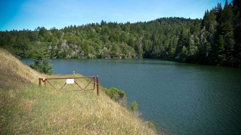
On the Road……NO CAMPING, NO BOATS, NO SWIMMING…
…NO OPEN FIRES, so says MMWD. Still, you can always ride a bicycle or go for a hike via the nearby Cataract Trail. (p.s. thanks to the group from SF who shared water and some delicious grapes at this scenic little spot).

On the Road……Alpine Lake Redux
Just another beautiful northern California October day.

Ride Report……Alpine Lake, there and back
Because it’s so close to my house, this is my “3x a week, and it still never gets old” ride. It’s usually what I do when I don’t have a destination in mind, but am itching to get out on the bike.
The route can also be incorporated into other rides (a long loop out to the coast and Highway 1 or a Panoramic Highway-Central Marin loop)
If I want to build strength and go fast I’ll ride my Guerciotti. If I’m feeling a little lazy, I’ll load the Ebisu‘s big handlebar bag full of snacks (some olives, maybe a little salami and cheese, some watered down red wine, and an apple) and go at a more leisurely pace, adding mileage by exploring some of the fire roads around the lake.
What makes it so interesting is the variation and scenic beauty. During the roughly 17 mile round trip you’re almost always climbing or descending; it’s rarely flat. In fact, in the first 3 miles there’s nearly 1,000 feet of elevation gain. This is followed by a long descent and then several more (yet easier) climbs and descents all the way to the lake.
The road curves its way through the foothills of Mt. Tamalpais with only 2 or 3 straight stretches and the terrain you pass through includes Redwood forests, scenic overlooks, and lots of water at the end. Plus, there are few cars to contend with even on week-ends.
What’s not to love?
Check out here, here, here, and here for some images made along this roadway.
On the Road……Duxberry Reef, Bolinas

A preview of the ride I’m planning this week: Duxbury Reef tide pools.
I made these photos last December during a 2-hour window right before sundown.
On the Road……Heading Toward the Summit of Mt. Tamalpais

This fellow was just hanging out in the middle of the road. I don’t know how I spotted him (I guess I was just looking in the middle of the road.)
On the Road……Heading Toward the Summit of Mt. Tamalpais

The ever present Sword fern (Polystichum munitum) — one sign that you’re in a redwood ecosystem or on some north facing slope.
On the Road……Near the Meadow Club
A rare sight: California grasslands with some green, rather than the typical burnt straw. This is the view looking to the northwest across from the Meadow Club on Bolinas Fairfax Road.

click to embiggen
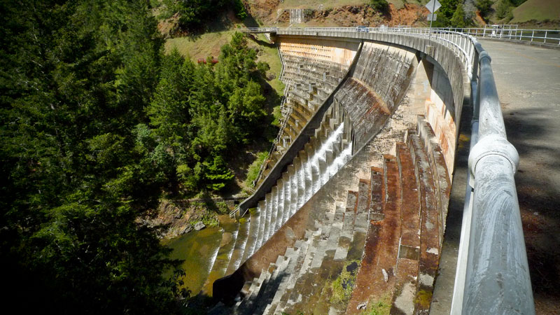
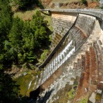
On the Road……Alpine Lake
Plenty of water at Alpine Lake, which is good for municipal water users like me. Note the dam’s spillway is flowing. A far cry from earlier this winter.
-
- click to enlarge
-
- click to enlarge