Archive for the ‘Highway 1’ tag
On the Road……Marshall Wall–Tomales Bay Loop
 Show on map
Staying out in Marshall, CA for a few nights afforded me the opportunity to try an epic Marin loop ride with two notorious hill climbs — the Marshall Wall and Wilson’s Hill. I really didn’t know what to expect; I don’t have many miles in the saddle this summer.
Here’s my impressionistic account of this classic 36-mile Marin ride:
Gear, clothing, and food: wool knickers, merino wool t-shirt, wool ankle socks, bata bikers, TA handlebar bag, basic tool kit, spare tire, single water bottle, small bag of trail mix, one apple, two sticks of string cheese.
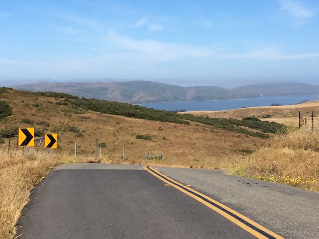
Miles 0-3, Marshall Petaluma Rd. heading east: What am I doing? I’m not ready for this. The climb starts so quick! Where’s the friggin’ bike shoulder? Some rancher in a pick-up truck is going to plow into me from behind on a blind curve. Wait a minute, I actually feel good. There’s no one out here but me! I’m standing up on the pedals. I feel strong. F**k yeah. Take that Marshall Wall. Boom! 750 feet of climbing in 3 miles. This ride is going to be a breeze!
Mile 4-10, Descending the Marshall Wall and beyond: A super steep 2-mile descent on pot-holed roads. Should be interesting. Wait! My guardian angel whispered something into my ear. Stop the bike. Check the brake and front tire. What? The front brake was disengaged! The front wheel’s quick release skewer was not set! Holy sh*t that was close. One bump and off comes the front wheel going 30 mph on a steep descent. Thank you Guradian Angel. Thank you!
Mile 11-13, Wilson’s Hill: Ok the second big climb of the day. I’m sure glad all this climbing is early in the ride. Wow that looks steep. I’m talking SF real estate prices steep. 10% grade at the top. Alpe d’Huez averages only 8.1. But Ok, this is going fine. Going good. Real good! No, it’s actually going quite badly now. This is very, very bad. How is it even physically possible for my tire to adhere to the road at this angle? Why is the asphalt not rolling off the road’s sub-surface and piling in a clump at the bottom of the hill? Why is darkness closing in around me? Who needs food, shelter, love? Hierarchy of needs dammit! All I need is to get to the top of this darn hill.
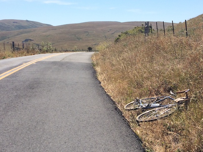
Mile 14-22, Chileno Valley Rd: How I love thee, Chileno Valley Road. Almost no cars. Perfect weather. No wind. Flat or very gently rolling roads. Scenery. Oh the scenery. A hidden gem of a bicycling road!
Mile 23-31, Tomales-Petaluma Rd: Did I make a wrong turn? Why am I going north? I’m getting tired. The wind seems to be picking up. That’s a mighty strong headwind. Hmmm. I hope it’s not much further. I’m not really hungry, but ‘eat before you’re hungry, drink before you’re thirsty,’ is the bicyclist’s motto. I’ll eat half a stick of string cheese. Oh my god, this headwind is brutal. It’s some kind of pacific ocean el nino tornado vortex. Why is CNN not covering this? Anderson? Anderson? Am I hallucinating or am I really in my 42×28 hill climbing gear riding on a flat road? I’m really sad now. Maintaining radio silence. Energy levels dropping.
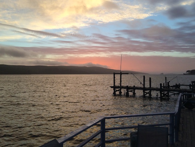
Mile 32-36, Shoreline Highway, Hwy 1: Food! I have food! Glorious food. No time to stop and eat. Just eat from the handlebar bag like it’s a trough. One hand on the bars, the other hand feeds the mouth. Bag of nuts. Done. Remaining string cheese. Done. Apple. Done. No! Not more rolling hills. Good god, these are steep. I thought this stretch was supposed to be flat. These are huge rollers. Up 150 feet. Down 150 feet. Rinse. Repeat. Legs burning. Yikes. Please be the last hill. Yes! Close to home. That’s Hog Island up ahead! Tomales Bay swim, hot tub, fresh oysters, and local ground-beef grilled hamburgers await!
Random Images……Cala lilies on Highway 1
In light of yesterday’s post, here’s some calla lilies (Zantedeschia aethiopica) that I photographed several weeks ago growing along Highway 1 in Marshall, CA.

On the Road……The Life Aquatic: Marshall, CA

If people ask me my favorite town in Marin County, I answer Marshall.
I do it for the puzzled look I inevitably get since few people have heard of the little community that has a population somewhere between 50 and 400.
My second favorite? Dogtown, with a population of 30.
On the Road……Tomales Bay, Marshall CA

The Marshall Store — one of many spots on the east side of Tomales Bay to stop for fresh oysters.
If you like shucking the oysters yourself, you should visit the Tomales Bay Oyster Co., Hog Island or Drakes Bay Oyster Co. (which continues to fight the Park Services’ decision prohibiting them from renewing their commercial lease to farm oysters in a nationally designated wilderness area).
On the Road……Pacific Coast, Highway One (revisited)
I suppose I miss living near the ocean because I recently found myself looking through these photos from a memorable one-day trip down Highway One to Santa Cruz made in the summer of ’09.
My brother rode a classic Trek with city bars (see the final image below) and I rode my quasi-touring Ebisu, fitted with some snazzy Nishiki front pannier bags that I found on Ebay.
The photos are a couple years old, but looking at them gives me so much pleasure that I’ve decided to post them anyhow (and give them a nostalgic vignetting to account for their age).
 Food and coffee stop…yum yum!
 No bike lane; no shoulder; no looking down!
 View to the northwest…the continent ends.
This is the last place. There is nowhere else to go.
Human movements,
but for a few,
are Westerly.
 More food; more coffee.
Nathan
On the Road……Olema’s Giant Eucalyptus Trees

The specimen below is probably the largest Eucalyptus I’ve seen. These trees are native to Australia and were originally planted in California — I’m guessing — as wind breaks for ranches and farms. They are quite draught resistant, making them extremely productive trees in this climatic zone. Plus, they smell really good!

On the Road……Highway 1 @ Vedanta Retreat, Olema

Just outside of Olema lies the Vedanta Retreat center.
I pedaled up the entry driveway past what they call the Vivekananda Bridge. There really was a palpable sense of peace and calm, maybe because for the last 37 years this has been a place “…where spiritual seekers of all faiths may meditate and study away from the disturbances of urban life.”
Here’s a synopsis of Vedanta philosophy from the Vedanta Society of Northern California‘s website:
The basic teaching of Vedanta is that the essence of all beings and all things–from the blade of grass to the Personal God–is Spirit, infinite and eternal, unchanging and indivisible. Vedanta emphasizes that man in his true nature is this divine Spirit, identical with the inmost being and reality of the universe. There is, in short, but one reality, one being, and, in the words of the Upanishads, “Thou art That.”
Vedanta declares that one can realize God in whatever aspect one wishes, and, further, that one can realize him directly and vividly in this life, in this world. Such realization constitutes spiritual freedom and contains in infinite measure the fulfillment of all man’s ideals and aspirations; it is indeed the true purpose of human life.
Vedanta holds that all religions lead to the same goal. Further, Vedanta reveres all great teachers and prophets, such as Sri Krishna, Lord Buddha, and Jesus Christ, and respects their teachings as the same eternal truth adapted to the needs of different times and peoples.

On the Road……Sir Francis Drake Blvd @ Highway 1

A typical Marin County bulletin board: “Holistic Lawyer”, “Way of the Goddess”, “Mystic Roots Band”, “Gurdjieff” and a plumbing contractor.

Downtown Olema

SFD Blvd @ Highway 1
Sir Francis Drake Blvd. is eponymously named after the English explorer, pirate, slaver, and planet circumnavigator (Sir Francis Drake, b.1540-1596) and was once slated to become a four-lane highway known as CA Route 251:
…However, the development and freeway planning were stopped due to concerns about fragile ecosystems that urbanization would have damaged or destroyed….There was another problem though: the plan put the entire area on the San Andreas Fault. The decision to not redevelop West Marin made the freeway unnecessary, and it was therefore scrapped (from the Wikipedia entry)
Route Map……US Hwy 1: Heading South from Olema
One really appreciates elevation gains/losses when on a bicycle. To wit, I’ve traveled this stretch by automobile dozens of times and on all those occasions I perceived the route as being perfectly flat.
Anyhow, this stretch of Highway 1 connects the small west Marin towns of Olema and Bolinas. You travel over rolling hills and past park land and old ranches while following the San Andreas earthquake fault along the valley floor. (I wrote a little about this natural history and geology in an earlier post).
On the Road……Olema, End of Indian Summer

I discovered a new swimming hole this year. Just in time, as Northern California’s Indian Summer (usually Sept-Oct) finally ushered in some genuinely hot weather.
Last year’s End of Summer post described another popular swim hole: the Inkwells.
The new spot is about a 15-mile roundtrip from the town of Olema, with mostly rolling hills and the occasional volley of cars skimming by pretty close as there is no shoulder for protection along Hwy 1.
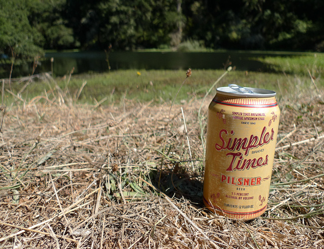
Simpler Times Pilsner
On the Road……Bolinas’ Missing Highway Sign

Click to embiggen
Highway 1: looking across at the approximate spot where the sign signaling the way to Bolinas (to the left) would be standing if the locals didn’t keep tearing it down to discourage outsiders from visiting.
On the Road……Santa Cruz, a few more photos

I wanted to bicycle out to the coast today, but a heat wave (103 degree F) made me rather lethargic. So here’s a few unpublished images from my recent Santa Cruz trip.
My brother (pictured) and I like this image because of its enigmatic time and geography: The Macedonian coastline, early 1960s perhaps.
For the actual location, remember to click the geotag icon below the image and use the zoom and map tools (switching to the satellite map type and zooming in very close is always interesting).
His bike is a really nice, old lugged Trek. That’s an Ostrich Bag on the front and a home-made pannier bag on the back.
On the Road……Santa Cruz

This is where your brussel sprouts come from……and the last bit of farmland before entering Santa Cruz (just past Wilder Ranch State Park).
One of my knees was really killing me at this point (and by killing me, I mean it felt like I was being stabbed in the knee with two screw drivers). I later discovered I had stupidly pedaled 100 miles on a saddle that was set too high. Lesson learned.
On the Road……Santa Cruz

The white sheen on the rocks? It’s guano, in case you were wondering.
On the Road……Heading to Santa Cruz, Hwy 1

Looking northwest, past Devil’s Slide along Highway 1.

