On the Road……Near UC Berkeley campus on Bancroft Avenue

 Show on map
Another picture of my traveling companion.
From here, I rode to the dowtown Berkeley BART station, folded up the Brompton, and took the train to the SF airport. At the airport, I repeated my successful gate checking of the Brompton.
Without a doubt, this little British folding bike helped make a great trip even better.
Nathan
On the Road……Jitensha Studio, Berkeley CA

Jitensha Studio projects a humble store front, yet inside Hiroshi Iimura — a modern bicycle constructeur — creates some of the most beautiful, functional, and harmoniously integrated bicycles I’ve ever seen.
A constructeur (as opposed to a framebuilder) assumes a holistic approach to bicycle creation. The constructeur integrates lighting, fenders, racks, and pannier bags; and, simultaneously, balances the bicycle’s intended use with its frame geometry, tire size, clearances, and a myriad of other choices, e.g., stem length, handlebar width, chain ring sizes, saddle and peddle type, etc., etc.
The most famous constructeurs of the 20th century were Rene Herse and Alex Singer, both from France. Hiroshi Iimura reflects this tradition.
I love this quote from Hiroshi published in a 2006 New York Times profile: “If a customer wants a component that is not to my taste, I refuse…I have to satisfy my own tastes first.”

Jitensha Studios, Berkeley, CA
Unfortunately, Hiroshi’s shop was closed the afternoon I was in Berkeley so I missed the chance to say hello. Although, I suspect he gets tired of people dropping by to say hello since he always seems to have a bicycle project or three in the works.

Jitensha Studio, Berkeley, CA
[Full disclosure: I own one of Hiroshi”s production Ebisu 650B models]
On the Road……Jorg & Olif Dutch commuter bike spotted in SF
A beautiful Jorg & Olif internally geared 8-speed with chain and skirt guards, rear rack, wicker basket, sprung saddle, double kick-stand, and a front generator light. The rider says she frequently commutes to work in the financial district on this classic ride.
It’s hard to say which is lovelier the bicycle or the rider?…I have to say — it’s the rider 🙂


On the Road……San Francsico’s Marina District
The next few posts will contain more images from my short trip to SF with my Brompton folding bicycle.

The SMART car and the Brompton make a good couple in a dense, urban city like San Francisco.

The Brompton fits snugly (from hatch-back door to seats), but rather perfectly in the Smart car’s tiny, cargo area.

As E.F. Schumacher wrote, “Small is Beautiful.“
On the Road……Brompton along the Waterfront

I’ve positioned the Brompton just north of Pier 1 and the Ferry Plaza (which boasts a good Saturday morning farmer’s market) with the western span of the Bay Bridge and Yerba Buena Island faintly visible in the background. It’s still early in the morning and there are few people around.
A new, eastern span of the bridge will open to automobile traffic in 2013 with a dedicated bike path (costing a cool $100 million) soon to follow. However, the western span (seen above) will still lack bicycle access.
Here’s an article with more details about this massive planning project. If you’re interested in getting involved in local bicycle advocacy issues, I’m sure these organizations would love to hear from you:
On the Road……Travelling with my Brompton in San Francsico

For a quick, week-end trip back to the Bay Area I wanted to travel light — no checked bags — just my folding bicycle and a backpack with the goal of leaving the airport via bike.
Last time I flew with the Brompton, I checked it as baggage. However, I had to deal with a giant, hard-shell suitcase once arriving at my destination.
So this time I tried a different approach: I brought the bike through security, put it on the x-ray machine’s conveyor belt, and gate checked it at the last minute like you would a child’s stroller.
The plan, which included carrying my back-pack on-board as a carry-on, worked perfectly.
The Brompton doubles as a luggage roller (albeit a tippy one) as you can see in the picture, made outside the Embarcadaro BART station early on a Saturday morning after my arrival from the airport.
At this point, I was able to easily ride to the Marina district where I was staying as well as make my way multi-modally (can I use this in adjective form?) to other appointments in both Marin and Berkeley.
End note: There is a solution to the Brompton suitcase dilemma which requires packing a portable, folding trailer. Here’s a chap elegantly demonstrating this option in a video in which he unpacks, assembles, and rides out of the Copenhagen airport on a Brompton with his luggage in tow.
Bicycling Culture……Le Tour de France
In honor of Day 1 — a few videos:
The first is a short history of the race highlighting many of its famous victors: Anquetil, Coppi, Hinault, Merckx, Armstrong, and my favorite Lemond.
The second video gives an idea of what this race looked like in the early days (the death defying descent at the 11 second mark is remarkable).
On the Road……Busted by Pima County Sheriff, Catalina Highway

I consider myself a very safe and considerate bicyclist, but I do practice the Idaho Stop Law when conditions permit such as:
- being outside the Tucson city limits;
- surrounded by desert; and,
- having clear lines of sight in all directions!
But this Pima County Sheriff was not buying my defense. In fact, I was given no warning and was issued a $200 citation for failure to stop at a stop sign, which he told me, carried the full automobile DMV points and insurance implications as though I had been operating an automobile.
Later, I found out the City of Tucson has a re-education program for scofflaws like me (which will wipe away the infraction)…I’m scheduled to attend this bicycle safety course next week-end.
For the record, this is the second time something like this has happened to me. I wrote about the first time here.
On the Road……Still Descending AZ’s Catalina Highway

Descending the Catalina highway toward Tucson.

With about 10-12 miles of downhill miles remaining, I’m feeling pretty good about the day.
On the Road……The Long Descent (of Catalina Highway)

After turning around at the Bear Canyon picnic spot it was all downhill (literally not metaphorically speaking) — 16 miles of pure descending.
I had to touch the brakes in a few tight curves, but otherwise I modulated my speed by raising or lowering my upper body relative to my bike’s top tube (thereby increasing or decreasing my wind resistance).
Ride Report……Mt Lemmon, Part II
I’m just now getting around to completing Part II of my ride report covering the scouting trip I made up the Catalina Highway toward Mt. Lemmon a number of weeks ago.
To recap: as I described in Part I, I was only about 6-7 miles and 2500 feet up the mountain before I began to succumb to the high temperatures, lack of water, and gusty winds.
However, as I contemplated ending my ride another bicyclist happened along. She had abandoned her efforts around the 11-12 mile mark anxious about the high wind and the dangers this could poise during the steep, twisting descent. Since she no longer needed all her liquids she offered me half a bottle, which contained some kind of energy, mineral, or electrolyte-infused water.
To my surprise, drinking this helped me recovery most of my energy and instilled a renewed spirit for pushing onward. As I climbed, I actually began to gain strength. I passed a group of three mountain bikers and settled into a good rhythm, climbing for another 5-6 miles which brought me to about 6,000 feet above sea level.
I pulled into the Bear Canyon picnic area around 3:30pm feeling really good.

I attribute much of these good feelings to the Ponderosa Pines (Pinus ponderosa) now populating the landscape. Seeing this majestic species with its distinctive orange-ish bark (a common sight when I bicycled in California) thrilled me to no end. Plus, it signified that I was transitioning through one of the many eco-zones along the route.
However, given that I was out of water again (and it would be 8-9 more uphill miles before I could count on finding more) I decided my exploratory ascent would end right here.
Next up: a quick, yet sublime, 16-mile descent to the valley floor.

Biking Culture……H.G. Wells and the Future of Humanity
A bicycling quote from the famous, socialist, pacifist, and sci-fi writer, H.G. Wells:
“When I see an adult on a bicycle, I do not despair for the future of the human race.”
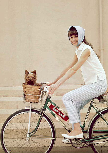
Audrey Hepburn
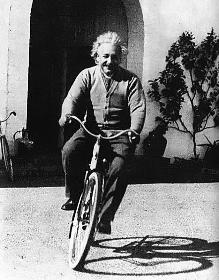
Albert Einstein
On the Road……Central Tucson’s Palo Verdes


I’m back in the desert, but recovering from an awful case of pneumonia valley fever — which is not good at all.
Nonetheless, I saw this lovely Palo Verde (Parkinsonia florida), which is Arizona’s state tree, while riding to pick-up my Honda from the dealership over on 22nd St.
These trees have green branches and trunks to help with photosynthesis, which comes in handy during droughts when the Palo Verde drops its leaves.
On the Road……DC, Captial Bikeshare…Part 2, the not-so-good

I ran into two issues while using the system:
- persistent shortages of open docks at the 21st and C St. station.
I would often snag the last remaining dock, then observe other riders pedaling away to look for another station to return their bike. I also observed an abandoned bike on the sidewalk because there were no spaces to dock it. Clearly, CaBi needs to add another docking module at this location.
- the kiosk’s touch screen failed me when I needed it most.
It was critical to be at work by 9am Friday morning. I finished my breakfast at Le Pain Quotidien in Dupont Circle (oatmeal, with fresh berries, OJ, and a cappuccino). I left myself 15-20 minutes to get down to C Street. I was a bit worried about the destination (since the Bixou app was telling me there were no docks available). But when I attempted to check-out a bike, the touch screen at the Dupont kiosk would not respond. Nothing. I was locked out…….TAXI!
The upshot: A great system, with some implementation issues. I unnecessarily spent $9 on taxi fare — not a big deal — but it did raise the cost of relying on CaBi by more than 50% (a 5-day CaBi membership is $15).
On the Road……DC, Capital Bikeshare…Part 1, the good

I spent five days using the CaBi system to make a simple, 3-mile, round trip commute while working in DC this past week. It was great. I loved not having to ride the metro or take the bus (or have to travel with my own bike).
As much as I enjoyed the system, I did experience a couple snafus that caused me to lose some confidence in the system (more on that in Part 2).
But I had no major complaints about the bike itself. I’m a big, big fan of the front rack and bungee cord. The system worked great for holding my satchel securely in place. The quibbles below are all relatively minor and somewhat subjective:
- the fenders are too short (as Dave pointed out in the previous post’s comments);
- the high gear (on the 3-speed hub) could be spaced a tad higher; and,
- the shift lag — on the bikes I rode — was quite noticeable.
There’s also an amazing (and in my opinion, indispensable) mobile phone app, Bixou, which lets you locate nearby stations and display live updates of both the number of bicycles and the number of open docks at any location.

Example of Bixou's interface, with data from the Paris system.
On the Road……The Nation’s Capital, Washington, DC

This post is a bit of a non sequitar since (in my previous post) I was in the middle of describing my ride up Mt. Lemmon. But I’ve been sent to DC for a week of work-related training giving me the opportunity to try out the Capital Bikeshare program and I thought I would post some images now, rather than wait.
How is the bike share program, you ask?
So far so good, although the persistent thunderstorms have made me keep a keen eye on the sky since I don’t have proper rain gear with me.
I’m staying in Dupont Circle (where I’ve been picking up a bike each morning) and riding to the Department of State (where the bike gets dropped off). The main streets along the way don’t have any designated bike lanes, but I’ve found some smaller, quieter streets that work well. Plus, drivers seem surprisingly tolerant of my existence — so far.
Ride Report……Toward the Summit of Mt. Lemmon, Part 1

My Mt. Lemmon ride was rather ill-planned, meant only as an exploratory trip to see what this mountain is all about.
It began on a Sunday afternoon, fueled by a morning capuchino and cinnamon roll from Cartel Coffee Lab (which was excellent and made me wish I had snapped a picture for an espresso review — click here for the review archives…but I digress).
Getting off to a late start (about 12:30 with the sun already directly above), I parked at the Safeway on Tanque Verde and Catalina Highway, 2-3 miles away from where the road begins to steepen. I wore wool shorts, some puma shot-putting shoes, a cotton tank-top with a lightweight, long-sleeve polyester shirt over that, a scarf-like buff around my neck, and zinc oxide sun protection on my face. I put a vietnamese-style baguette sandwich in my handlebar bag and a full water bottle in my downtube cage.
I felt great the first 7 miles as I climbed the initial few thousand feet. With each switchback the valley began fading away. I remarked to myself that this was the most comfortable I’ve felt on a bike since coming to Tucson: few cars, scenic views, and to me, the satisfying rhythm of a long, hard hill climb (which is what I was used to in California).
Just after making the above picture of this prickly pear cactus, the sound of rapid gunshots rang out from a pickup truck directly across the road. I quickly ascertained the pistoleros were not aiming their bullets at me, but I still felt vulnerable. I didn’t linger.
As I covered this initial ground, I guzzled water at a rate that naively assumed I could fill-up at the numerous official campgrounds en-route (e.g. at mile 6, 12, 18 etc.). So I rolled into the Molino Basin Campground — at around 1:30pm and well into the heat of the day — with a nearly empty water bottle. It was only then that I learned there would be no more water until the Palisades ranger station (more than 14 miles ahead and 4,000 feet above me).
I gamely rode another mile or so, but began to tire. The hot and extremely windy conditions made for tough riding. At times, it felt as though I was barely moving at all as I hammered my lowest gear into 30-mph gusting headwinds.
The opportunity to take a rest and eat something arrived in the form of the Gordon Hirabayashi recreation site. My energy was mostly spent and I was out of H2O. I ate half a sandwich and thought that this would be the end of my climb….
…TO BE CONTINUED in PART II
 Tired, thirsty, and hunkered down in a small patch of shade.

On the Road……Toward the Summit of Mt. Lemmon

This past Sunday I decided to head toward the top of Mt. Lemmon to see how far I could get. It’s a tough 20+ mile ride going from the desert floor (at around 2,000′ of elevation) all the way up to a subalpine forest (around 9,000′).
I hope to have a detailed report and more pictures soon. Suffice it to say: I only made it about half way (around 6,000′ just below Windy Point).
Q: do you notice anything wrong with the picture above?
A: the single water bottle (and lack of water along the route), which proved to be my critical undoing!
On the Road……Tucson Front Yards (more)

FOR SALE…$25…FIRM, which begs the question: the mattress or the asking price? Or both?
On the Road……Tucson Front Yards

Tucson front yards are quirky and full of character…These are along my regular 3rd St./Rosewood commute.

On the Road……Near the Alamo Wash on Rosewood St.

Tucson is blessed with what the locals call “washes” essentially dry riverbeds that channel water during heavy rains. In New Mexico (where I went to high school) we called them “arroyos“. I think they are one and the same.
Theoretically these washes perform the function of habitat corridors in an otherwise highly fragmented urban landscape. I’m not familiar enough yet with the city’s urban ecology to know for certain, but I’ll bet bobcats, javelinas, and other assorted critters make use of these.
This particular wash, bisects the bikeway I use to get to work. It was a partly cloudy day so I stopped and made a few pictures.

On the Road……Tour of the Tucson Mountains, cont’d.

Here we have the results posted in the finish area. My time was 4:42, including stops for refreshments, photography, and a flat tire.
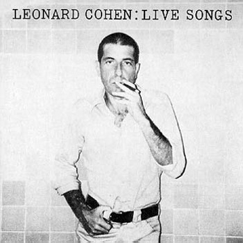
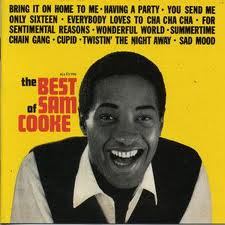
Bookman’s, the jersey sponsor above, is a Tucson institution. They buy, sell, and trade books, digital media, and other sundry items — including used vinyl (and while the selection doesn’t compare to the likes of Amoeba Records in Berkeley, I was happy to find some old Leonard Cohen and Sam Cooke records when I stopped by).

The only snack I wanted after this long hot ride was H2O-melon!
On the Road……Tour of the Tucson Mountains, cont’d

Here we have aid station #3, about 30 miles into the ride, which unbeknownst to me was about 1000′ away from the spot where I had my first mishap — a flat tire.
I expected a couple flats during the ride. I seem to pick up lots of cactus thorns in AZ. So I stuffed an extra tube, tire irons, even a patch kit into my TA handlebar bag. What I hadn’t expected was for my trusty silca frame pump (which I wrote about here and here) to fail me.
So I waited, and waited…and watched dozens of cyclists stream past before a kind gentleman (whose name I never caught) riding a recumbent bicycle offered me use of his pump. I lost about 25 minutes and was quite surprised to crest the next gentle slope and see this aid station.
Nathan

On the Road……Tour of the Tucson Mountains

This is the view of the mass start at about 6:25am for the 25th anniversary, 73-mile perimeter ride around the Tucson Mountains.
I started toward the very back — about 600 riders deep — amidst a sea of muti-colored and neon jerseys. It took about 3 minutes to actually cross the “start” line after the bell sounded.
I wore some traditional black wool bicycling shorts, a long sleeve white t-shirt, and my Adidas Chile ’62 shoes (because I like the way their knobby soles grip the pedals when I use toe-clips and leather straps).
Timed rides like this are usually not my thing, but I figured it would be a good way to get a sense of the local bicycling scene. I hope to post some more thoughts on that subject, and more pictures from this ride, soon.
Nathan
On the Road……3rd Street-University Bikeway, Tucson

Here’s the 3rd St. bike way (looking east west) which is the bike path I take when riding my bike to work.
Near the University there’s some good infrastructure (like the special bike crossing above), but unfortunately as you travel east the bikeway ends at Wilmot (about a mile before my destination). I’m then forced to ride on one of Tucson’s mega-six lane boulevards (along a narrow stripped bike lane) for about another mile.
This (and the fact that I pedal directly into a glaring sun each morning AND afternoon — since I ride due east in the AM and due west in the PM) will be a test of how dedicated I remain to riding my bike to work.
Nathan
On the Road……The Teddy Bear Chollo of Sabino Canyon

I’m still getting settled here in Tucson, but I’m making an effort to sustain my 11-mile, round trip, bicycle commute to work (at least before the temperatures reach the triple digits).
Tucson’s beautiful Sabino Canyon is open to bicyclists after 5:00pm, which is where this image was made.
The subject seen here is my current favorite cactus: the Opuntia bigelovii or Teddy Bear Cholla.
Nathan
Featured Comment by Laura: “It looks like it was a hard dry winter for that area, so not much of a spring bloom. It’s one of the great joys of the desert to see it in bloom, so if you’re there next year I hope it’s a good one! This site is useful for checking out what’s happening with the fleurs. http://www.desertusa.com/wildflo/wildupdates.html (lots of ads, but the info is good.) I have indeed removed teddy bear cactus spines with pliers. Not from my own calf, I’m happy to say–it weren’t pretty.”
Nathan replies: What a great website. It confirmed the two other blooming plants I’ve been seeing around Tucson. One is the Hedgehog (Echinocereus) and the other is the Ocotillo (Fouquieria splendens), which is my new, new favorite cactus — but it turns out it is not actually a cactus! (P.S. Laura is a talented botanist pursuing her PhD in Ecology and Evolutionary Biology at Brown University. I always appreciate her comments when I attempt to write about the plant kingdom).
On the Road……Good-bye SF Bay Area — Hello Tucson, AZ?!

Sad, but true. I’m relocating to Tucson, AZ and (at least for now) leaving the Bay Area.
The truck, my Honda, and the bikes in tow, make for a pretty long rig! Rolling into and out of gas stations (see picture below) was not easy. And I was always concerned about pulling in some place and not being able to get out again.
Anyhow, Tucson is supposed to be a great biking city so once things settle down I hope to continue dispatching bike-related rides and photos from the Southwest.

On the Road……Marin Headlands toward Pt. Bonita

It’s not obvious from the picture, but this fellow is chatting away on his mobile phone while taking in this awesome view.
To get to this spot I went through an old WWII tunnel off of Conzelman Rd. heading toward the southwestern tip of Pt. Reyes. Then, I scampered up a ridge going to the summit of Hawk Hill (where volunteer bird watchers tally an average of more than 9,000 turkey vulture, 9,000 red-tailed hawk, and 4 bald eagle sightings each year). But before the ridge turns toward the summit, through a stand of trees, there’s this awesome view looking toward the lighthouse.
In the middle of the tunnel, on the way up to this spot, is some graffiti suggestive of the famous cave art of Lascaux. Lightning was awful (about 80 percent darkness), but I used a tripod and a 25-second exposure to make this image.

Finally, here’s an example of some of the new road work on the way to the lighthouse (the view is looking back to the east — with the guardrail shielding a precipitous drop-off to the ocean).

I’m taking a leave from my National Park Service (NPS) photography duties. So these three images will likely be the last I’ll post from this gig.
Biking Culture……Portland Bike Culture Parody
On the Road……San Francisco: January’s “Warm Wave”

It’s been really warm this past week (70s in some spots) and it’s only January! Many trees are starting to flower if you can believe it. Great for cycling, not so great for the fruit trees (presuming it gets cold again).
Anyhow, the above image was made from the bike path on Lincoln Ave. above Crissy Field. The image below is from the same spot, but looking north.

…and below is a close-up of what was happening down on Crissy Field (I made this with a very long telephoto lens). All three are archival images that I produced as a photography volunteer for the National Park Service/Golden Gate National Recreation Area. I’m grateful to be able to share the images and for the chance to volunteer in the GGNRA. Here’s a link to all their volunteer opportunities in case you’re interested.

On the Road……Bolinas-Fairfax Road, near the Lake Lagunitas turn-off

This may not look that steep, but it often feels it (as it’s part of a fairly long climb that eventually crests at the top of the Bolinas ridge).
This rider is almost to the Lake Lagunitas turn.
Bicycle-Coffee Culture……San Francisco’s Coffee Wars
A Ken Burns-style mockumentary, which hits pretty close to home.
Espresso Review……Equator Coffees and Teas

Two expertly prepared espressos (by company co-founder Helen Russell)
Why is it that Blue Bottle, Ritual, and Four Barrel get most of the street cred in these parts, when northern California’s Equator Coffee pioneered artisan coffee roasting’s renaissance more than 15 years ago?
Recently, I was lucky enough to have an opportunity to drop by and chat about this and other topics with Helen Russell, a co-founder of Equator Coffee — one of the country’s top artisan coffee roasteries — which happens to be headquartered right here in Marin County (San Rafael).
Everyone on the staff (from Maureen in operations to David in coffee buying) is passionate about coffee and extremely generous with their time.
So if you have a chance to try Equator’s coffee, I recommend starting with their organic Ethiopian Amaro Gayo — I tasted the distinctive flavor and aroma of ripe blueberries when I brewed this at home using my portable Hario grinder and a french press. And it received a score of 92 at CoffeeReview.
Equator Coffee: Highly Recommended!
On the Road……Tucson, Arizona – Snow!

I drove from the Bay Area to Tucson, AZ the day after Xmas for a quick 2-day visit with my dad.
I brought my bike hoping to try the famous Mt. Lemmon ride, but a combination of insufficient time and snowy weather prevented me from giving it a go. (I’m in pretty poor bicycling shape so it’s 50-50 whether I even could have made the 25-mile climb up to 8,000 feet.)

A sad bicycle sitting idle, poolside.
On the Road……Sutro Baths, Cliff House: San Francisco

Here are a few more of my photos from outings for the National Park Service/GGNRA.
Above, the cyclist is making his way up the hill just past the Cliff House. Beyond the picket fence is a steep cliff dropping off to the Sutro Baths ruins.

On the Road……Marin Headlands, New Road Construction

Conzelman Road begins at the north end of the Golden Gate Bridge and heads west to the Pt. Bonita Lighthouse. There’s been lots of construction work recently: new parking areas, roundabouts, and road widening (see how the cliff face has been cutback from the road).
I made the above image on a recent outing for the National Park Service and thank them for permitting me to post it here (photo courtesy NPS).
Biking Culture……Does a Heavy Bike Slow your Commute???

A heavy (but not cheap) dutch-style commuting bike
There’s an interesting article in the British Medical Journal on bicycle weight and commuting time. In summary, it was found that riding a much heavier bike, over a regular, 27-mile commute, did NOT affect overall commuting time. (The article abstract is reprinted below.)
While the Dutch seem to have discovered this on their own my impression is that Americans still tend to commute on lightweight racing-style bikes. This causes us to pedal with great exertion and wear funny shoes and clothes, with little choice but to shower and change at the office.
That is, the USA is still a country where bicycling is viewed mostly as recreation or exercise — not transportation.
Abstract
Objective To determine whether the author’s 20.9 lb (9.5 kg) carbon frame bicycle reduced commuting time compared with his 29.75 lb (13.5 kg) steel frame bicycle.
Design Randomised trial.
Setting Sheffield and Chesterfield, United Kingdom, between mid-January 2010 and mid-July 2010.
Participants One consultant in anaesthesia and intensive care.
Main outcome measure Total time to complete the 27 mile (43.5 kilometre) journey from Sheffield to Chesterfield Royal Hospital and back.
Results The total distance travelled on the steel frame bicycle during the study period was 809 miles (1302 km) and on the carbon frame bicycle was 711 miles (1144 km). The difference in the mean journey time between the steel and carbon bicycles was 00:00:32 (hr:min:sec; 95% CI –00:03:34 to 00:02:30; P=0.72).
Conclusions A lighter bicycle did not lead to a detectable difference in commuting time. Cyclists may find it more cost effective to reduce their own weight rather than to purchase a lighter bicycle. [Emphasis added]
Biking Culture……The Human Element: Walking versus Biking

Crow Planet: Essential Wisdom from the Urban Wilderness by Lyanda Lynn Haupt
I’ve extolled the virtues of bicycling as an ideal form of locomotion on these pages before, for example:
“The bike is a wonderful machine: it lets you explore more terrain than you can on foot on a given day, yet it is still a humane technology connecting your body and senses to nature in ways not really possible with an automobile (from Velosophy).”
“…for me riding a bike is good mindfulness practice: It helps me to regain peace of mind after a hard day and helps me to observe my everyday world with a somewhat greater sense of clarity (from this post).”
However, this passage from a book I just finished, Crow Planet: Essential Wisdom from the Urban Wilderness by Lyanda Lynn Haupt, makes a very strong case for walking:
Walking is the pace that we were born to. It is the pace at which our eyes focus, our thoughts can keep up, and our bodies can feel evolved and grounded and whole. Walking we are on an axis about which we can turn to look, or bend to see, or squat to pick up. Walking, we feel knowing and self-reliant, inhabitants of our own bodies, and in cahoots with the bodies of others.
She also uses excerpts from Thoreau’s Walking to bolster her argument.
Thoreau is hard to argue with and I’ll admit walking has its charms.
In fact, one of my favorite tools is Walk Score — which ranks places to live on a scale of 1 to 100 in terms of how walkable they are (e.g. proximity to grocery stores, libraries, post offices, cafes, etc.).
On the Road……Trees of Fort Mason II: the Norfolk Pine

 This is a Conifer species that was new to me, the so called Norfolk Island Pine (Araucaria heterophylla) which is endemic to a small eponomously named island in the South Pacific. Norfolk Island looks like quite a vernal landscape with low temperatures rarely below 50 degrees F (and high temperatures rising to only about 80 degrees F), which may explain why this specimen appears to be doing quite well in San Francisco.


