Archive for the ‘BICYCLING CALIFORNIA’ Category
On the Road……The Warming Hut, San Francisco
These are vistas from near The Warming Hut — a touristy, but perfectly located place to stop for a snack (at either the picnic tables or at the cafe).
I didn’t try their coffee, so I cannot comment…Perhaps next time.

 Beyond the bicycles, a little of the San Francisco skyline is visible (note the gold dome of the Palace of Fine Arts).
 That’s not my coffee cup, really.
On the Road……A picnic table near Fort Point, San Francisco
Some photos made last month (looking northeast from a picnic table about half-way between the Bridge and Crissy Field).

Bicycle Collage
On the Road……Olema’s Giant Eucalyptus Trees

The specimen below is probably the largest Eucalyptus I’ve seen. These trees are native to Australia and were originally planted in California — I’m guessing — as wind breaks for ranches and farms. They are quite draught resistant, making them extremely productive trees in this climatic zone. Plus, they smell really good!

On the Road……Highway 1 @ Vedanta Retreat, Olema

Just outside of Olema lies the Vedanta Retreat center.
I pedaled up the entry driveway past what they call the Vivekananda Bridge. There really was a palpable sense of peace and calm, maybe because for the last 37 years this has been a place “…where spiritual seekers of all faiths may meditate and study away from the disturbances of urban life.”
Here’s a synopsis of Vedanta philosophy from the Vedanta Society of Northern California‘s website:
The basic teaching of Vedanta is that the essence of all beings and all things–from the blade of grass to the Personal God–is Spirit, infinite and eternal, unchanging and indivisible. Vedanta emphasizes that man in his true nature is this divine Spirit, identical with the inmost being and reality of the universe. There is, in short, but one reality, one being, and, in the words of the Upanishads, “Thou art That.”
Vedanta declares that one can realize God in whatever aspect one wishes, and, further, that one can realize him directly and vividly in this life, in this world. Such realization constitutes spiritual freedom and contains in infinite measure the fulfillment of all man’s ideals and aspirations; it is indeed the true purpose of human life.
Vedanta holds that all religions lead to the same goal. Further, Vedanta reveres all great teachers and prophets, such as Sri Krishna, Lord Buddha, and Jesus Christ, and respects their teachings as the same eternal truth adapted to the needs of different times and peoples.

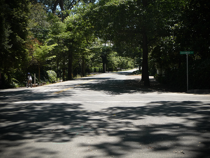
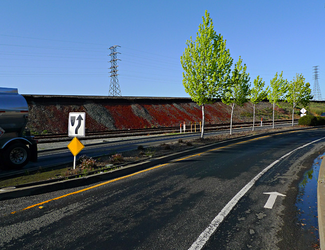
On the Road……Sir Francis Drake Blvd @ Highway 1

A typical Marin County bulletin board: “Holistic Lawyer”, “Way of the Goddess”, “Mystic Roots Band”, “Gurdjieff” and a plumbing contractor.

Downtown Olema

SFD Blvd @ Highway 1
Sir Francis Drake Blvd. is eponymously named after the English explorer, pirate, slaver, and planet circumnavigator (Sir Francis Drake, b.1540-1596) and was once slated to become a four-lane highway known as CA Route 251:
…However, the development and freeway planning were stopped due to concerns about fragile ecosystems that urbanization would have damaged or destroyed….There was another problem though: the plan put the entire area on the San Andreas Fault. The decision to not redevelop West Marin made the freeway unnecessary, and it was therefore scrapped (from the Wikipedia entry)
On the Road……Olema, End of Indian Summer

I discovered a new swimming hole this year. Just in time, as Northern California’s Indian Summer (usually Sept-Oct) finally ushered in some genuinely hot weather.
Last year’s End of Summer post described another popular swim hole: the Inkwells.
The new spot is about a 15-mile roundtrip from the town of Olema, with mostly rolling hills and the occasional volley of cars skimming by pretty close as there is no shoulder for protection along Hwy 1.
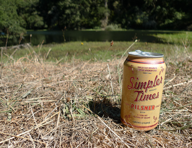
Simpler Times Pilsner
On the Road……Bon Tempe Lake & Reservoir
A quick bike ride up the mountain to Bon Tempe Lake to recalibrate mind/body.

 A native Madrone (Arbutus menziesii) — one of my favorite trees with its curious exfoliating bark.
 The fading of the light.
On the Road……SF’s Golden Gate Bridge, Westside, North Tower

On the Road……SF’s Golden Gate Bridge

On the Road……Guerciotti on the Golden Gate Bridge

I recently did some exploring around the Golden Gate Bridge (and down by The Warming Hut).
This view is from the western side of the bridge looking toward the south-west. I believe the Seacliff/Richmond neighborhood is visible in the background.
On the Road……China Camp State Park, San Rafael

China Camp State Park borders the San Pablo Bay. Less well-known than the San Francisco Bay, San Pablo Bay has its own low-key charm.
The lagoons and picnic areas around China Camp are great places to stop for a beer, some food, or just to soak your feet (if not go for a swim). Plus, the trails in the surrounding hills draw mountain bikers from around the region.
The name of the park derives from the 1880s Chinese shrimp fishing village that once thrived here.

Note: right pant leg tucked carefully into sock.
On the Road……N. San Pedro Rd, heading to China Camp State Park

On the Road……Bicycling, Carbon Footprints, and a Sense of Wonder
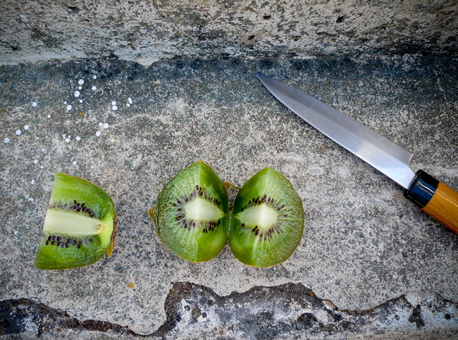
Organic New Zealand Kiwi Fruit
I recently pedaled up to Alpine Lake and had the foresight to pack a little fruit and one of these spiffy stainless steel Japanese Suncraft knives.
As I bit into this juicy kiwi, I remember thinking:
How is it that I’m sitting here now and eating a tiny fruit that was harvested on the other side of the earth?
There was no judgment over the astronomical (one might even say grotesque) carbon footprint of my organic New Zealand kiwi – it was simply a sense of wonder that I live at a time in human history where such an act is even possible.

Note: After writing the above post I discovered that a “sense of wonder” is a recognized concept in science fiction literature. It’s related to a “numinous” experience. Here’s an excerpt from the Wikipedia entry:
The sense of wonder is related to, but not identical to, the concept of the numinous…the numinous, in this case, is the understanding that there is something not directly comprehensible, but large and entirely other, in the world. The sense of wonder, by contrast, is the understanding that there is something that one had not fully comprehended — or perhaps had not even recognized that there was something to be comprehended — until that point.
Bicycling Culture……The Bike Blog Universe

The Velo Hobo (aka Jack from North Carolina) was kind enough to spotlight me in one of his recent “featured rider” posts.
Initially, I told him I was a little embarrassed by the distinction. The cycling community is full of so many riders that are accomplishing amazing physical feats or doing other extraordinary things with bicycles. I felt a little inadequate in this regard. But I’ll continue to do my part, whatever that may be. Thanks Jack!
And this reminds me. I’ve been remiss in acknowledging other blogging friends and supporters of The Friday Cyclotouriste to whom I am most grateful. They include:
- Myles at Rat Trap Press;
- Eddie at The Everyday Cyclist;
- Esteban at velo-flaneur;
- Alan and Michael at EcoVelo;
- Meli at Bikes and the City; and,
- Dave at Yurtville.
All are amazing blogs. I encourage you to visit.
(P.S. The above picture, which I sent to Jack, was made with the camera on the ground using the 10-second timer on a recent Thursday evening ride up the hill near Alpine Lake).
On the Road……Two Angel Island Ebisu Portraits

Along the Tiburon promenade with Angel Island and San Francisco in the background.

I’m starting to prefer the tighter field of view of this image vs. the (similar) image I posted earlier.
On the Road……Panorama, Paradise Drive, Tiburon

TIburon peninsula on the left. Angel Island on the right.
A beautiful, sunny day in this micro-climate, but note the white clouds around the island. That’s fog enveloping most of the bay (as seen in the pictures in the above post made not too long after this one). As I mentioned in my ride report, I was tempted to bail out on this ride. I’m really glad I didn’t.
On the Road……Paradise Drive, Corte Madera & Tiburon

Descending into Tiburon
 Now that’s a small shoulder
 Seen here from Paradise Drive, San Quentin prison (far horizon in the center) sits on some prime real estate .
 Agave americana. I love these. Supposedly they live 100 years, then die in a magnificent, colorful bloom.
On the Road……Corte Madera Tidal Marsh
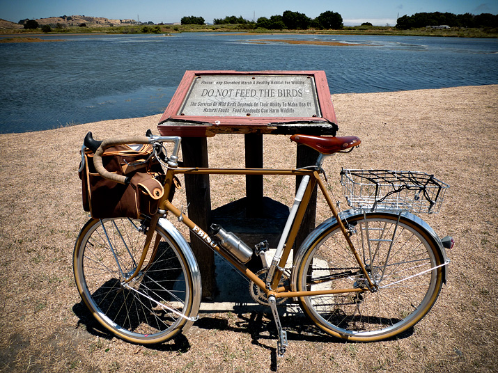
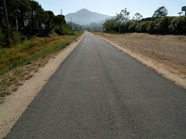
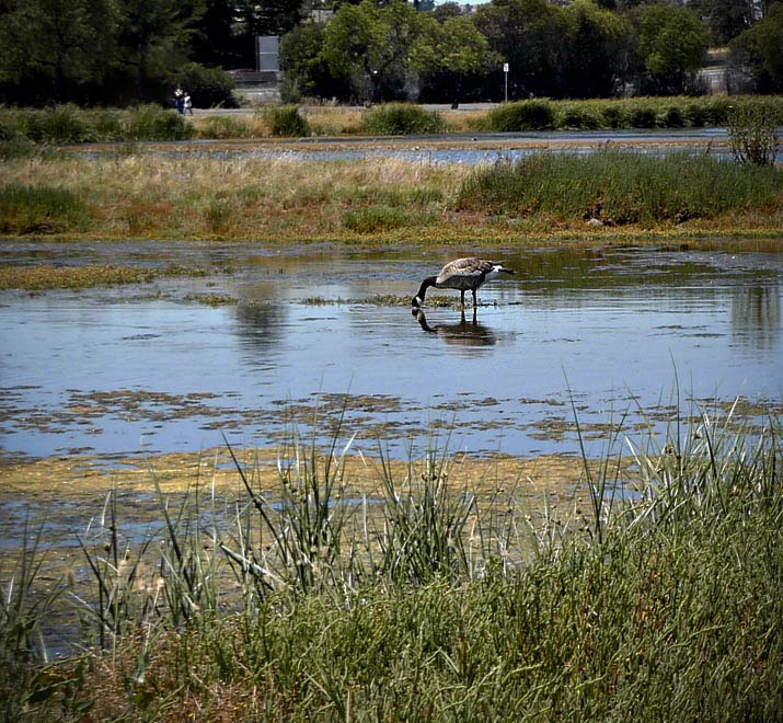
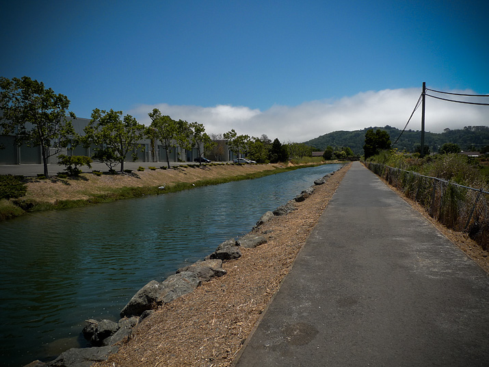
These are images of the Corte Madera Marsh and some bike paths leading to it (discussed in my earlier ride report)
That’s a Canadian goose on the lower left (the geotag shows the spot of this photo). I think the geese use this wetland as a stopover of some kind, but where they go and from whence they come — I do not know.
On a good day the marsh is also full of Egrets, Snowy Plovers, Pelicans, and various ducks.
The marsh is situated within an active urban landscape with:
- the towns of Greenbrae and Larkspur to the north
- a big shopping mall and the Tiburon peninsula to the south
- the San Francisco Bay and the San Quentin Prison to the east
- Highway 101 and the foothills of Mt. Tam to the west
The amount of water in the marsh is infuenced by tide levels and winter rains so there are always new islands and water channels appearing and disappearing day-to-day.
On the Road……Kids on Bikes at Tiburon Ferry Landing

Some future bicyle advocates returning from Angel Island while I wait to board.
On the Road……Ferryboat Plying the SF Bay, Tiburon

From Shoreline Park in Tiburon, looking southwest with Belvedere “island” and the Golden Gate Bridge in the background
Ride Report……Fairfax-to-Angel Island
Having a goal or purpose is important in life and in cycling.
That doesn’t mean you always need a purpose — sometimes it’s okay to allow spontaneity and impulse be your guide.
But on this ride, having the goal of riding to, and circumambulating, Angel Island was critical. Without that goal I would have turned around after 30 minutes because of the extreme gusty wind and fog.
The ride was about 40 miles round trip. I carried water and one PB&J (I ate a hearty late breakfast and didn’t require much else). I wore cotton pants, a cotton t-shirt, a cotton long-sleeve collared shirt. I also brought a thinly-insulated zip-up hoodie for extra layering (but my big regret was not bringing a beanie or cap).
It was sunny and warm when I left Fairfax at about 12:15pm, and the first part of the ride was spent meandering through central Marin towns and cities: the little bike path on the canal behind College of Marin and the path along Corte Madera Creek.
But as I approached the marsh near the Village Shopping Center the winds picked up — probably 15-20 mph head and cross winds with gusts to 25-30 mph on certain straightaways. Gusts flared around nearly every bend of Paradise Drive as I rode the long serpentine back road, past the Romberg Tiburon Center for Environmental Studies, to downtown Tiburon and the Angel Island ferry.
A mile from downtown, the fog and wind let up. The azure sky and stately homes along Marin’s gold coast (Belvedere and Tiburon) stood gloriously against the choppy Bay and the San Francisco skyline. I suddenly felt happy after more than an hour of not-so-happy pedaling.
I had to wait about 20-25 minutes and then caught the 3:00pm ferry across the Raccoon Strait to Angel Island.
When I arrived on the island the fog and wind picked up again and I made a head-down, very earnest turning-of-the-cranks circumambulation of the island. The initial plan was to follow the high fire road, which is the closest a bicycle can get to the top of Mt. Livermore (741′ EL). But the signage was poor and I somehow missed the turn.
Truth be told, I was kind of glad I missed my turn. This way I could follow the more popular (and gentler) Perimeter Road loop and get back to the quay a bit before the 4:20pm return ferry (since I was initially expecting to return on the last ferryboat of the day leaving an hour later.)
Of course, I couldn’t resist stopping for an espresso and a tira misu at Caffe Acri (review to come) once I was back on the mainland. Now, sufficiently energized, I rode furiously home while getting slammed by head winds for most of the trip (but also catching a few miles of tremendous tailwinds — for which I thank the spirit of St. Velocio).
A bit past 6pm, I arrived home to a memorable hot shower.
All in all, it was a frustratingly beautiful day on the bicycle, and well worth the effort!
Route Map……Fairfax to Angel Island by Land & by Sea
gpsbabel_output[maptype=G_Physical_Map; zoom=11]
Here’s a gps file of the ride to Angel Island. The mileage on the elevation profile is one-way. And the point where the pink line ends on the upper map is where my gps data logger ran out of batteries. It wasn’t a bad place for this to happen, however, as by that time the route was already nearly fully logged and delineated.
Remember you can change map types or zoom in or out to taste, using the Google map control buttons.
On the Road……Shady Lane, the Town of Ross
Until the Cal-Park tunnel re-opens to pedestrians and bikers (and trains someday too) all rides heading south from Fairfax (e.g. to San Francisco, Mill Valley, Sausalito, etc.) will likely pass through the Town of Ross.
The enfant terrible, Sean Penn, has a home here and the street above, Shady lane, was featured in Francis Coppola’s film, The Godfather.
The image was made in the first few miles of my roughly 40-mile Angel Island excursion.
On the Road……San Francisco Bay’s, Angel Island

I bicycled to Angel Island (via ferry) over the long holiday week-end. It was a typical July day on the San Francisco Bay — patches of brilliant sunshine mixed with belts of fog and massive wind gusts, due to cold ocean air being sucked into warmer inland areas.
The image above was made on the SW side of the island below the summit of Mount Caroline Livermore (El. 788′). Note downtown SF, Alcatraz, and the Golden Gate Bridge in the background. (You can click on the image for an expanded view).
(Wikipedia fact: Angel Island was part of the mainland until about 10,000 years ago, when sea levels rose as the last ice age came to an end.)
More images, a map, a short ride report, and an espresso review to come.
On the Road……Marin County Fair
One more picture from the fair last weekend.

On the Road……”These Aren’t The Droids You’re Looking For”


Here’s a video clip of Obi-Wan using some Jedi mind tricks in STAR WARS episode IV.
May the Force be with you.
On the Road……WalkBikeMarin @ County Fair
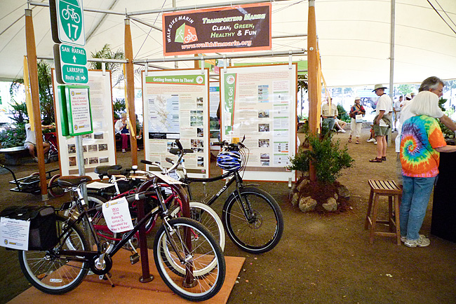
WalkBikeMarin Display at Marin County Fair
The company I’m working with this summer, Alta Planning + Design, is deeply involved as a consultant in a $25 million federal pilot project to test the effectiveness of using federal funds to increase the modal share of bicycling and walking. The mechanism to accomplish these goals is infrastructure improvements and public education.
So I spent a day at the Marin County Fair sharing information about the program with fair goers.
Here’s a link to a comprehensive list of bicycle projects underway in Marin and, just for fun, here’s a few comparative statistics (from Alliance for Walking and Biking):
- The Netherlands invests about $39/resident on bicycling and walking compared to $1.50/resident for the U.S.
- Their share of bicycling trips is 27%; ours is 1%.
Espresso Review……Mojay’s Cafe, San Rafael

Formerly known as Shaky Grounds, this cafe has a new name so I decided to stop in for a visit. The place is now run by espresso drinkers (and World Cup futbol fans) so I immediately took a liking to the atmosphere.
Mojay’s Cafe is on the 4th St. bike route so it’s a convenient place to stop if you’re riding east-west through San Rafael. The menu seems to have a little bit of everything, including Italian Panini. The tenant next door also happens to be a bike shop: Summit Bicycles.
Okay, okay, so how’s the espresso experience you ask? Well, I give it very high marks:
- The presentation is excellent: my espresso was served in an elegant and appropriately sized cup and saucer. On my first visit, the espresso even came with a mini-biscotti and a small spoon (all without having to ask). This was a nice touch and shows a better understanding of espresso culture than one normally finds around here.
- The 100% organic espresso tasted just right and had very good crema.
- Fresh drinking water is available from a self serve station and Wi-Fi is free.
Now, we’ll see if Mojay’s can deliver all this consistently. If so, I may have found my new favorite espresso stop.
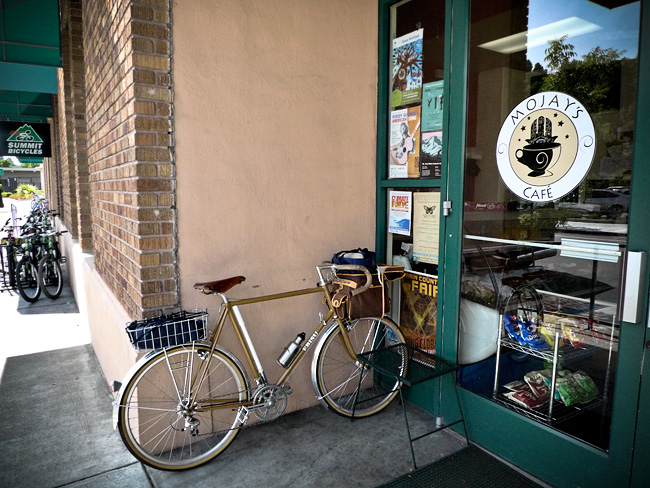
Ebisu in waiting, Mojay's Cafe
On the Road……Bicycling is not a Crime

For the first time in my life, I was pulled over by the police while riding a bicycle (during my morning commute).
I’ll explain in a moment, but first a short digression:
- I usually go out of my way to ride conservatively because I see so many bicyclists riding recklessly, which only invites motorists’ anger. (Of course, it’s equally true that many, if not most, motorists drive irrationally, impatiently, and aggressively in terms of how they interact with bicyclists).
- I like to think I see the folly of both sides and so whether I’m piloting a car or a bike, I try to keep the other in mind and set a good example.
Nonetheless, on this day, I rolled through a stop sign fairly quickly after seeing no on-coming cars. Local law enforcement was hiding on a nearby side street. I didn’t see the squad car, but I heard the siren from behind a few blocks later and knew I was busted.
I gave my best Idaho Stop defense and after producing my driver’s license was mercifully only given a short lecture and let go with a warning.
If you’ve never heard of the Idaho Stop law here’s an elegant little video.
On the Road……Frank Lloyd Wright’s Atrium Garden

I recently discovered a fantastic blog, Tokyo Green Space, which examines ways that biodiversity and urban form coexist in Tokyo. It inspired me to take a closer look at the dialogue between nature and urban design in my own backyard.
On a lunch time bike ride to the Civic Center, I made these pictures of the ground floor garden inside Wright’s famous architectural commission.
 An earlier post included images of the outside of the building.
On the Road……Frank Lloyd Wright’s Civic Center

Ebisu parked inside the Civic Center
After cruising north to the Civic Center during a week-day lunch break and finding no bike parking out front, I brought the Ebisu inside and, of course, made a quick picture. Here are a few more:

Courtyard and base of spire

Courtyard off cafeteria
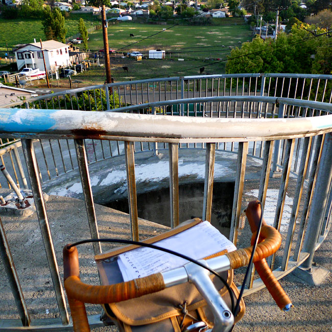
Ride Report……Port Costa Loop, Part II

Long overdue, this is Part II of my ride report.
(Here is Part I and here again is the map of the route).
The broad outlines of this ride came to me as I looked at the location of my friends’ house on a map. This would be a circumnavigation, via two major urban bridges, of the Carquinez strait — a watery narrows that California’s two mighty rivers, the Sacramento and San Joaquin, must pass through before emptying into the San Pablo and San Francisco Bays.
Port Costa — surrounded by rolling green hills — was the perfect launching point for such a ride.
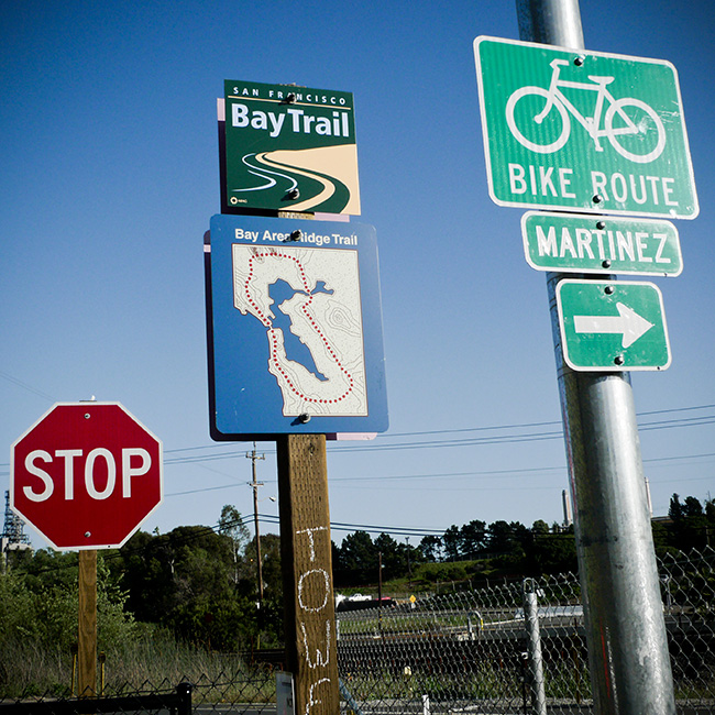
Miles 0-10: From Port Costa to Martinez bicyclists can use the old highway, which is closed to car traffic. I passed the occasional hiker and was treated to rolling hills, scenic views of the water and the old rail road tracks, and a final, satisfying descent into the town of Martinez. I breezed in feeling energized and thus decided to go looking for the John Muir historic monument rather than sticking to the course I had initially set. (Read about that side trip here).
Miles 11-20: The second third of the trip took me from downtown Martinez across the Benicia Bridge to Southampton Bay and the Benicia state recreation area. This was easy, pleasant riding never too far from the shoreline. I rode past past marinas filled with expensive yachts and late Sunday afternoon picnic goers. I stopped frequently to make photographs and found my way using a variety of bike paths and shared roads. I was never entirely sure if I was on my planned route, but I wasn’t too concerned as “Bike Route” signs were plentiful and all roads seemed to propel me toward the state park.
Miles 21-30: During the last third of the trip, after leaving Benicia state park, the route finding and bicycle riding became more difficult. The bike lane ended and I had to navigate a number of challenges:
- first was a curving, shoulder-less off-ramp leading up to Columbus Parkway and a narrow two-way bridge near the intersection with I-780.
- route finding became more difficult since I screwed up my Google bicycling directions by accidentally printing a mirror image of the route (starting at point B going to A, rather than A to B). As a result, I had to read the directions backwards (from the bottom of the page up) and calculate whether left and right turns were also reversed. It was a mess.
- a critical street sign was missing and as I pedaled up what seemed the biggest incline of the trip I was unsure if was even on the correct road (later I confirmed I was on Benicia Rd.).
- in order to find the approach to the bike/ped path of the Carquinez Bridge I had to cross three major interstates (I-780 2 times and I-80 once) and pedal through a few gritty urban neighborhoods (riding in normal street clothes, rather then a skintight lycra outfit, never felt more right).
- since I began my journey after 4:30pm the onset of darkness was a real issue (I don’t have a lighting system on this bike).

So, I pedaled hard the last 6-7 miles, crossed the Carquinez Bridge as the sun dropped below the horizon, and managed to arrive back in Port Costa just after 8pm.
My friends had taken a twilight stroll and were not yet home. I was a little tired and rather hungry (since I didn’t eat anything on route), but took solace in the satisfaction of having just circumnavigated the Carquinez Strait.
On the Road……Local Bodega, Vallejo CA
On the Road……I-780 Overpass

On the Road……My three least favorite words: BIKE LANE ENDS

On the Road……Carquinez Strait Loop, near Benicia
Part 1 of my ride report was published awhile back. Stay tuned for Part II and the last of the photos from this scenic loop ride.
* Remember you can always click the  Show on map under the photo to view the location on a map.
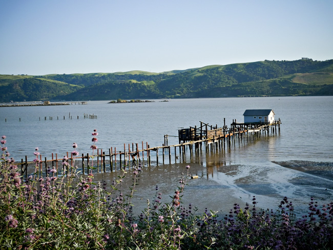
View of the Carquenez Strait looking south from Benicia
The photo caption says it all.
On the Road……Port Costa/Carquinez Strait Loop

I don’t know much about these except that they are often called ice plants, which is a bit of a misnomer since they’re quite hardy and thrive in full sunshine.
Most likely these are a pesky invasive species. Nonetheless, they’re often growing en masse along California highways. The flowers’ vivid color is impressive when in full bloom.
On the Road……Port Costa/Carquinez Strait Loop
Getting on the Martinez-Benicia Bridge
Most of this route has well-marked signage. (But over the last third of the ride I did have a little trouble finding my way. See Part II of my ride report for details.)
On the Road……Carquinez Strait Loop, near the Benicia Bridge
Excellent Class II BIke Lane
Among urban planners:
- Class I is a completely separate bicycle/pedestrian path or roadway (like you see all over Holland).
- Class II is when there’s a separate lane for bicycles (like in this photo).
- Class III is just a shared road, maybe with some road markers here and there.
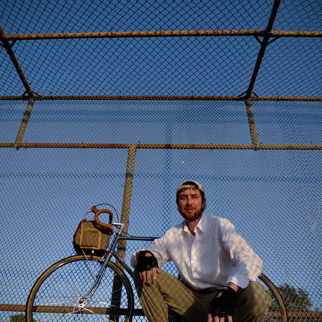
On the Road……Martinez, and the John Muir House
 You can see from the little squiggle on the Port Costa route map that I made a slight detour from my planned loop.
Here’s what happened:
Noticing the sign “Martinez” as I entered town caused a little voice deep inside my head to say clearly: “Martinez is known for something...?”
It took a few blocks of me pondering, “Martinez, Martinez” and then it struck me — John Muir’s House is in Martinez!
I stopped to ask directions and it was easy enough to find. I went a few miles south on Alhambra Avenue toward Highway 4 and there it was on the right, just past a Vietnamese nail salon and a Subway sandwich shop.
John Muir is one of my all-time heroes. He’s up there with Bodhidharma, Gandhi, Emerson, Thoreau, Gary Snyder, Wendell Berry, Ed Abbey, Aldo Leopold, Cabeza de Vaca, Charlie Chaplin, Walt Whitman, Muhammad Ali, and Velocio.
So I was a little disappointed the historic landmark was closed for the day when I arrived. I just peered in, past the parking lot gate. The place felt a bit sad and ironic, surrounded by its suburban infrastructure.
Even in his day, Muir was not entirely happy in Martinez, so far from the cheerful water ouzel and his beloved High Sierra.
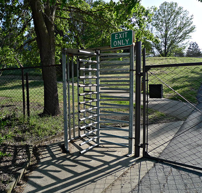
Exit Gate of the John Muir Historic Landmark

