Archive for the ‘BICYCLING CALIFORNIA’ Category
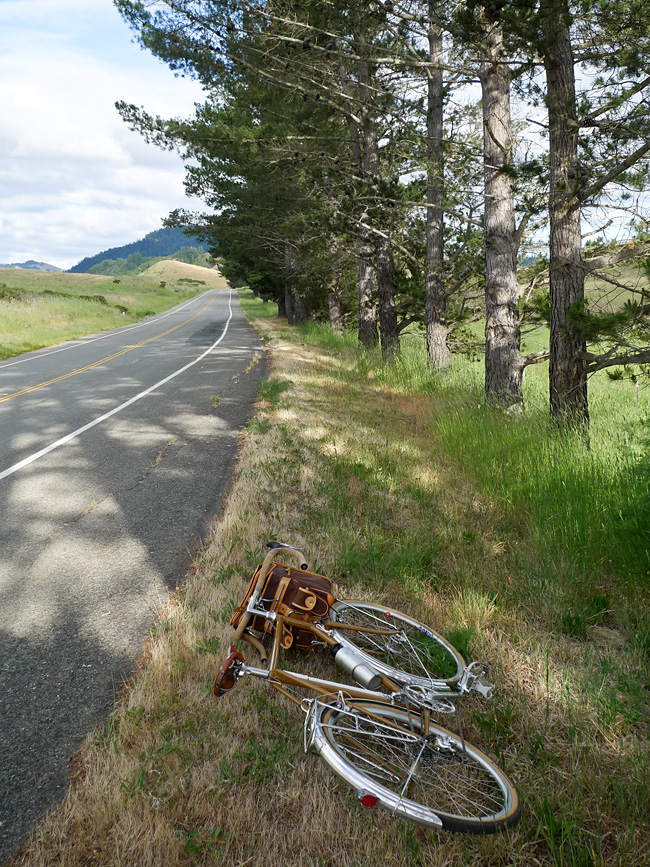
On the Road……Port Costa Loop, Old Martinez Highway

Heading east for Martinez on the old highway from Port Costa, I was treated to a rare stretch without any car traffic. This old road is now closed to vehicles and it’s starting to break apart in places — reclaimed by the forces of wild nature!
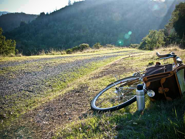
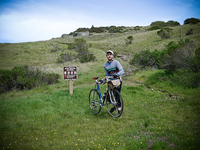
Ride Report……Port Costa Loop, Part I

On Saturday, my friends Forest and Ingrid invited me out to their place in Port Costa — a quirky, Bay Area town (that almost no one has heard of) along the Carquinez strait, surrounded by parks, open space, rolling hills, ravines, pastures, and water views.
I brought my Guerciotti along so I might sneak in a bike ride. I didn’t have a specific route in mind, but the weather was ideal and I anticipated the area would have some great roads.
Ingrid is from Romania and she prepared a delightful tray of appetizers: home-made bread, thinly sliced daikon radish, country cheese, raw milk, strawberries, olives, honey, and sun-dried tomato tapenade. I washed it down with a refreshing Pilsener and then we took a walk down to the old railroad tracks and the shoreline.
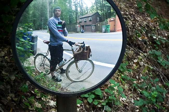
Standing near the water, I realized a grand loop around the Carquinez Strait was possible — provided the two bridges accommodated bikes. A neighbor confirmed they do and so I printed out some Google bicycling directions and set out for a ride.
I departed Port Costa around 4:40pm with just a small bottle of water and the food in my belly. I wore my regular clothes: corduroy pants and a lightweight, long sleeve collared shirt over a cotton t-shirt, cotton socks, a baseball cap, Adidas Sambas, and a lightweight hoodie (which I stowed in my handlebar bag should it get cold around sundown).
TO BE CONTINUED…in Part II
Route Map……Port Costa Loop
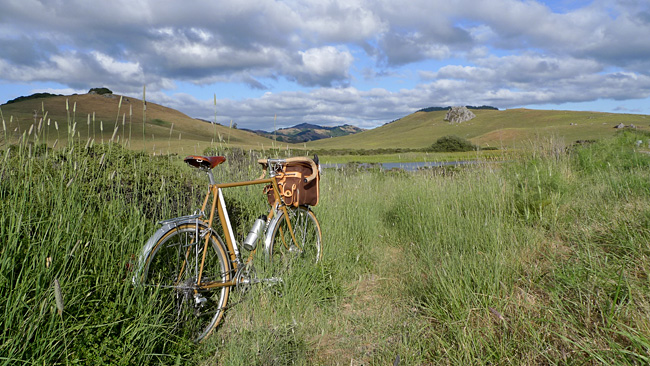
On the Road……Port Costa Loop Ride

That’s Mount Diablo (El. 3,864′) on the horizon. The slopes and trails of Diablo are where Grant Petersen and the good folks at Rivendell Bicycle Works do their thing.
On the Road……Port Costa Loop Ride

On the Road……Spring time at Azalea Hill Pass
This past Friday I intended to ride to Alpine Lake and back, one of the top 10 short bicycle rides known to humankind IMHO.
But I got distracted by all the wildflowers and only made it to the top of Azalea Hill.
Last time up here I made this photo. I thought I’d share an alternative version highlighting my flashy yellow wind breaker.

And here’s a clumsy attempt to make another 10-second timed exposure at the nearby trail head. (The ground is super saturated and muddy. I had trouble getting set before the shutter released.)
Azalea Hill Trail Head
On the Road……Cumulus Clouds heading toward Azalea Hill

On the Road……Heading toward Azalea Hill Pass

On the Road……St. Rita’s Church in Fairfax

April 13th. I can’t put off doing my taxes any longer. So I take a quick ride to my local library to pick up some tax forms.
After I get my forms, I’m suddenly struck by the view looking across the street at St. Rita’s Church.
Time to make a quick portrait of the Nishiki Mixte, I think.
For better or for worse, this pretty much sums up the way most of my photos come about: spontaneously and a quite randomly.
On the Road……Gate 5 Road, Sausalito
Sausalito’s houseboat community — and the dock Otis Redding sat upon while writing, “(Sittin’ On) The Dock of the Bay”

On the Road……Gate 5 Road, Sausalito


On the Road……Sorich Ranch Park, below San Rafael Ridge
March showers bring April flowers…just down the street from the dog park!

Not sure the species, don’t think they’re native.
Cape Daisies, originally from the South Africa, according to my botanist friend, Laura.
On the Road……Meadow Club, Fairfax

I live in a region with a drought prone mediterranean climate and so expressing one’s feelings about the rain (its frequency and abundance) is a local past-time and, I think, a reflection of becoming a true inhabitant of this dynamic ecological assemblage.
I love the rain — especially late season March/April rains, but it also reduces my riding (above is a fair weather picture from a mid-month ride).
And despite many rumors to the contrary, rainfall this year is just “average”. But “average” = “great” because now our reservoirs are finally full.
Stats from MMWD’s website:
Average year-to-date rainfall (inches): 46.3
Actual year-to-date rainfall (inches): 45.1
Current, reservoir storage (% of capacity): 99
Same time last year, reservoir storage (% of capacity): 84
Now we need to hope plans to restore native Coho salmon populations will soon start paying off.
On the Road……San Rafael Ridge Loop
It’s Spring…the hills have never been greener!

Great views from the ridge, some extending to downtown San Francisco. Lots of dog walkers and hikers — not many bicyclists up here, though.
On the Road……San Rafael Ridge Loop
The purple line marks paved roads. The green line marks the fire road connecting Ridgewood Rd. in San Rafael to Fawn Dr. in San Anselmo.
On the Road……Near West Portal, San Francisco

On the Road……To Lake Lagunitas
Lake Lagunitas
Lagunita (the Spanish word for ‘little lake’) is the oldest and smallest lake in the watershed. It is also the highest in elevation (notice it’s relationship to the summit of Mt. Tam in the background).
Once you ride up here there’s a lovely little path circling the lake (see my route map).
But calling Lagunitas a lake is a bit of a misnomer: Lagunitas is really a man-made reservoir. One of seven reservoirs providing 75% of the county’s water supply.
The future of this supply is threatened, according to MMWD:
Our analyses show that current water supply will be insufficient to meet projected demand. This shortage would become severe in the event of a serious drought…We can get through one or possibly two dry years, but we would not be able to adequately supply our community in a longer drought.
Yikes!
Luckily, someone is paying atention. The intrepid little non-profit, Sustainable Fairfax is once again taking the lead:
Water project staff and volunteers will be approaching every business, school and resident in Fairfax to see “How Far We Can Go” to reduce our water use through technology and behavior. The idea is to focus intensively on one community to increase water conservation to see if that is an effective model resulting in long-term water savings.
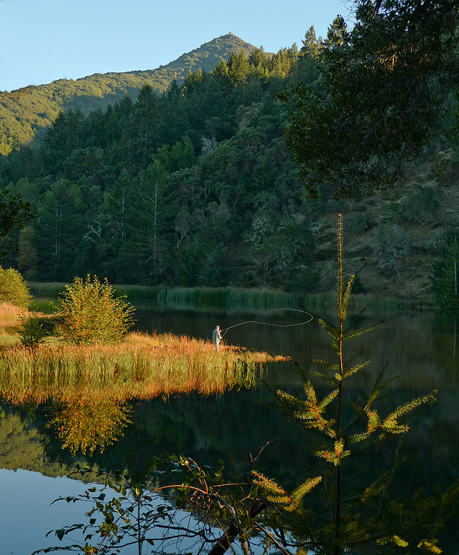
(Note: It was too dark when I arrived to get a satisfactory image. The above shot of Lake Lagunitas was made this past summer…yes, fishing with a permit is allowed.)
On the Road……Near Bon Tempe Lake
You wouldn’t know it, but this is a picture of three wild turkeys (if you squint and use a little imagination you might see them). I was on my bicycle and it was dusk so all I got was this colorful blur.
Still, I think the picture kind of works as an abstract.
Riding around at sundown is usually a good time to see wildlife. I saw three deer and six wild turkeys.
Three Turkeys (Bon Tempe Lake)
On the Road……To Lake Lagunitas – birthplace of mtn. biking

On the Road……To Lake Lagunitas
Last evening the rain let up and I made the quick trip up to Lake Lagunitas. The ride is short, steep, and so very scenic (about 8-10 miles roundtrip with 800′ of elevation gain).
It’s the sort of ride to take when there’s only about an hour of sunlight left in the day. By this time, everything is quieter and water district rangers have shooed away the remaining visitors in automobiles. Only us bicyclists — and the various critters that emerge to forage at this magical time — are left to watch the fading of the light.
While I was off my bike (camera in hand) a small posse of mountain bikers appeared clucking “Hoo Koo E Koo” as they pedaled by.

On the Road……To Lake Lagunitas
On the Road……Azalea Hill (EL 1,217′)

Atop Azalea Hill
There’s a lot of cloud cover, but the East Bay is just visible on the far horizon. Mt. Tamalpais is the third peak from the right with Bon Tempe Lake right below.
(I combined five images to capture the whole panorama. Here’s my favorite example of this technique: Nicasio reservoir.)
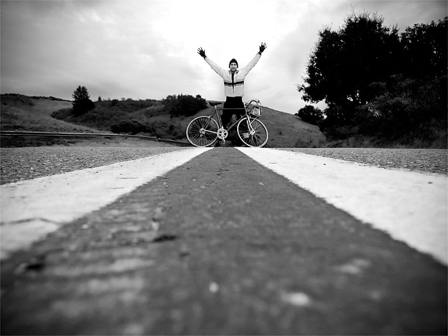
On the Road……Azalea Hill pass (EL 1,080′)
The making of this photo: (1) place camera directly on road (2) set the 10 second timer (3) grab bike (4) run into the frame and hope to hit a good mark to optimize composition and hope for no cars (5) wait for shutter to fire — still hoping for no cars to come up from behind (6) get the camera and myself off the road as quickly as possible.
I tried this twice (this was the first). It worked just as I had hoped!
Azalea Hill pass
This is an important spot — the intersection of Bolinas-Fairfax and Pine Mountain (fire) roads. Mountain bikers and hikers will often drive here to start at the trail head; road bicyclists will often rest and take water here.
By all means, make the short 10 minute hike from this pass to the top of Azalea Hill (EL 1,217′). You’ll be rewarded with a 360 degree vista including a great view of Mt. Tamalpais and Bon Tempe lake and sight lines extending across the bay to the Campanile on the UC Berkeley campus and continuing on to Mt. Diablo.
On the Road……Suburbia

the suburbs
On the Road……Suburbia

The Suburbs #2
 Show on map (note the view of Mt. Tam)

The Suburbs #3

The Suburbs #4
After reading the first few chapters of David Byrnes’s Bicycle Diaries, I’ve become hyper-aware of the aesthetics of the local suburban landscape. Byrne writes about the underlying paradox of this landscape in the book:
My generation makes fun of the suburbs and the shopping malls, the TV commercials and the sitcoms we grew up with — but they’re part of us too. So our ironic view is leavened with something like love…These suburbs, where so many of us spent our formative years, still push emotional buttons for us; they’re both attractive and deeply disturbing.
I also enjoyed this bit from the Talking Heads co-founder on the joys he experienced after switching to a bicycle as his main mode of transportation around New York City:
As I got a little older I also may have thought that cycling was a convenient way to get exercise, but at first I wasn’t thinking of that. It just felt good to cruise down the dirty potholed streets. It was exhilarating. That same sense of liberation I experienced in New York recurred as I pedaled around many of the world’s principal cities. I felt more connected to life on the streets than I would have in a car or in some form of public transit: I could stop whenever I wanted to; it was often (very often) faster than a car or taxi for getting from point A to point B; and I didn’t have to follow any set route. The same exhilaration, as the air and street life whizzed by, happened again in each town. It was, for me, addictive.
I had a similar epiphany when I starting riding my bicycle again after a long lay-off as a graduate student in Berkeley.
On the Road……Farmer’s Market loop

Espresso Review……Marin Coffee Roasters, San Anselmo

Marin Coffee Roasters
Marin Coffee Roasters is an ideal place for a shot of espresso. There’s sunny, outdoor sidewalk seating and it’s on a major bike path connecting San Francisco to West Marin (click here for a jpeg of a bicycle path map courtesy of the MCBC site).
I broke my month-long coffee fast here which may have skewed my perceptions, but I rank this as one of the best espressos I’ve had in Marin.
I’m a little surprised because my understanding is the owner doesn’t roast on site, but rather receives his beans from the 25lb. San Franciscan roaster at the Fairfax Roastery. Read the rest of this entry »
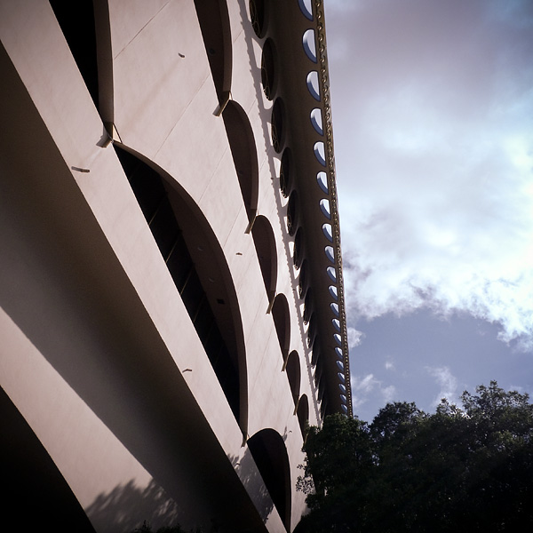
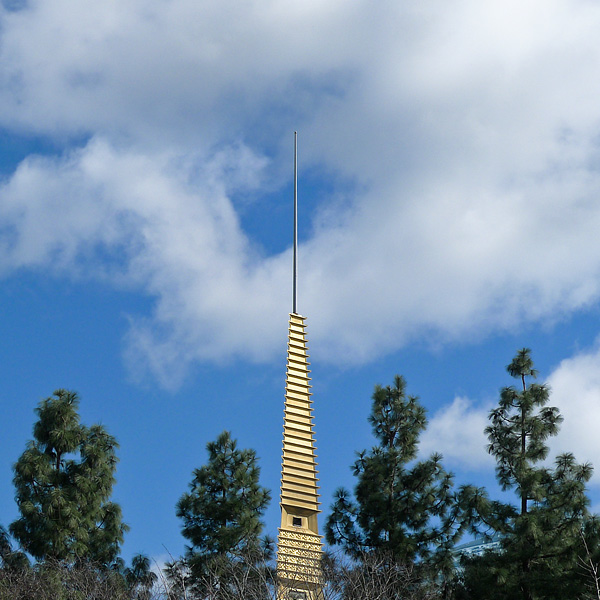
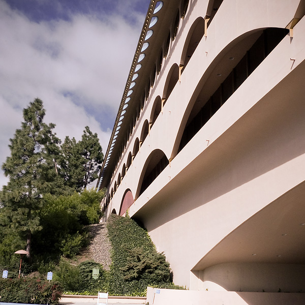
On the Road……Frank Lloyd Wright’s Marin County Civic Center
Here’s a link (and video) with some of the back story of Frank Lloyd Wright‘s awesome building.
Did you know scenes from Gattaca were filmed here, as were scenes from THX-1138 — Marin resident George Lucas’ pre-Star Wars, pre-American Graffiti film?
- If you’ve heard of either of these cult sci-fi films, especially THX-1138, it’s time to face the facts. Ready? Let’s say it together: You are a nerd!
- And if by chance you’ve heard of both Gattaca and THX-1138, I can confidently predict you also know a few things about D&D.
Btw, the Civic Center has a farmer’s market every Thursday and Sunday year-round.
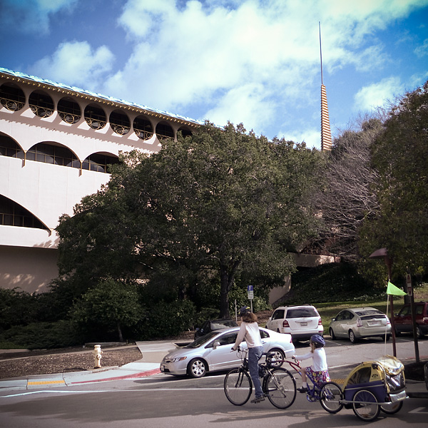
On the Road……Civic Center Farmer’s Market

On the Road……Super Bowl Sunday
The view from the the top of the secret (or not-so-secret) bike path connecting San Rafael to San Anselmo that I mentioned here. From the San Rafael side, the path connects with Fawn Drive in San Anselmo.
I’m returning from the farmer’s market and the Ebisu’s rear rack is filled with leeks, carrots, and onions; the front bag with a dozen eggs, a head of cabbage, a turnip, and a shallot.
Oh yeah, congratulations to the Super Bowl champions — the New Orleans Saints!

On the Road……San Anselmo

old schwinn
On the Road……Cataract Mushroom Gallery
Last week, instead of biking I went for a rainy day hike up the Cataract Trail to Laurel Dell. Lots of mushrooms, but not a Chanterelle to be found 🙁

On the Road…Laurel Dell snack
Persimmon bread and — for a change — some tea!

On the Road……Cataract to Laurel Dell

Let’s pack up and take off and dig Laurel Dell camp. Then we’ll hike over the trails down to the sea and swim.
That’s Japhy Ryder from the Jack Kerouac novel, Dharma Bums. Kerouac based the Japhy character on my personal hero, poet Gary Snyder. Kerouac’s narrator continues below with some local references to areas around Mt. Tam. He takes some poetic license with his description of the landscape and the distinction between Laurel Dell and Portrero Meadows, but still, how cool to have these places I know so well immortalized in a Jack Kerouac novel:
We arrived at Laurel Dell camp at about ten, it was also supplied with stone fireplaces with grates, and picnic table, but the surroundings were infinitely more beautiful than Portrero Meadows. Here were the real meadows: dreamy beauties with soft grass sloping all around, fringed by heavy deep green timber, the whole scene of waving grass and brooks and nothing in sight.
On the Road……Cataract to Laurel Dell

On the Road……Rain, Rain, Rain
In between rain showers I went for a little ride around downtown Fairfax today. I spied this cruiser, parked under an awning to keep it dry, I guess. Not even a lock! It’s all good.

On the Road……Nicasio Valley Road

This image was buried in my cleaning house 2009 posting. On second viewing, it deserves full-size treatment. A few others from that gallery will probably show up full size as well, if they deserve it.
On the Road……Happy New Year!
The Friday Cyclotouriste wishes everyone a happy New Year’s Day, 2010. As you spread the joy and benefits of riding bicycles this year may you suffer few flats, encounter many interesting people, consume delicious food and drink, and experience only tailwinds during all your rides!

On the Road……From the 2009 Archives
For whatever reason, certain images never got posted during 2009. So this is some year-end housekeeping.
This shot is from the crest of the hill on Sir Francis Drake Blvd. just before descending into the town of Olema.

On the Road……More unpublished 2009 photos
Here’s a few more. Click to make big.